Sainte-Françoise, Quebec (parish)
Sainte-Françoise | |
|---|---|
Parish municipality | |
 | |
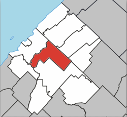 Location within Les Basques RCM | |
 Sainte-Françoise Location in eastern Quebec | |
| Coordinates: 48°06′N 69°04′W / 48.1°N 69.07°WCoordinates: 48°06′N 69°04′W / 48.1°N 69.07°W[1] | |
| Country | |
| Province | |
| Region | Bas-Saint-Laurent |
| RCM | Les Basques |
| Constituted | December 6, 1873 |
| Government | |
| • Mayor | Simon Lavoie |
| • Federal riding | Rimouski-Neigette—Témiscouata —Les Basques |
| • Prov. riding | Rivière-du-Loup-Témiscouata |
| Area | |
| • Total | 89.40 km2 (34.52 sq mi) |
| • Land | 88.07 km2 (34.00 sq mi) |
| Population | |
| • Total | 399 |
| • Density | 4.5/km2 (12/sq mi) |
| • Pop 2006-2011 | |
| • Dwellings | 229 |
| Time zone | UTC−5 (EST) |
| • Summer (DST) | UTC−4 (EDT) |
| Postal code(s) | G0L 3B0 |
| Area code(s) | 418 and 581 |
| Highways | |

Sainte-Françoise is a parish municipality in the Bas-Saint-Laurent region of Quebec, Canada.
Demographics[]
Population[]
hide
Canada census – Sainte-Françoise, Quebec (parish) community profile
| 2011 | |
|---|---|
| Population | 399 (-7.4% from 2006) |
| Land area | 88.07 km2 (34.00 sq mi) |
| Population density | 4.5/km2 (12/sq mi) |
| Median age | 52.6 (M: 53.5, F: 51.6) |
| Total private dwellings | 229 |
| Median household income | $40,716 |
| Year | Pop. | ±% |
|---|---|---|
| 1991 | 506 | — |
| 1996 | 467 | −7.7% |
| 2001 | 453 | −3.0% |
| 2006 | 431 | −4.9% |
| 2011 | 399 | −7.4% |
Language[]
| Canada Census Mother Tongue - Sainte-Françoise, Bas-Saint-Laurent, Quebec[7] | ||||||||||||||||||
|---|---|---|---|---|---|---|---|---|---|---|---|---|---|---|---|---|---|---|
| Census | Total | French
|
English
|
French & English
|
Other
| |||||||||||||
| Year | Responses | Count | Trend | Pop % | Count | Trend | Pop % | Count | Trend | Pop % | Count | Trend | Pop % | |||||
2011
|
405
|
395 | 97.53% | 5 | 1.23% | 5 | 1.23% | 0 | 0.00% | |||||||||
2006
|
420
|
410 | 97.62% | 0 | 0.00% | 0 | 0.00% | 10 | 2.38% | |||||||||
2001
|
450
|
450 | 100.00% | 0 | 0.00% | 0 | 0.00% | 0 | 0.00% | |||||||||
1996
|
465
|
465 | n/a | 100.00% | 0 | n/a | 0.00% | 0 | n/a | 0.00% | 0 | n/a | 0.00% | |||||
See also[]
References[]
- ^ Reference number 56176 of the Commission de toponymie du Québec (in French)
- ^ Jump up to: a b Geographic code 11030 in the official Répertoire des municipalités (in French)
- ^ Jump up to: a b "(Code 2411030) Census Profile". 2011 census. Statistics Canada. 2012.
- ^ "2011 Community Profiles". 2011 Canadian Census. Statistics Canada. March 21, 2019. Retrieved 2014-03-11.
- ^ "2006 Community Profiles". 2006 Canadian Census. Statistics Canada. August 20, 2019.
- ^ "2001 Community Profiles". 2001 Canadian Census. Statistics Canada. July 18, 2021.
- ^ Jump up to: a b Statistics Canada: 1996, 2001, 2006, 2011 census
External links[]
 Media related to Sainte-Françoise, Bas-Saint-Laurent, Quebec at Wikimedia Commons
| show Adjacent Municipal Subdivisions |
|---|
| hide | |
|---|---|
| Cities & Towns | |
| Municipalities |
|
| Parishes | |
| Unorganized territories | |
| |
This Bas-Saint-Laurent location article is a stub. You can help Wikipedia by . |
Categories:
- Parish municipalities in Quebec
- Incorporated places in Bas-Saint-Laurent
- Bas-Saint-Laurent geography stubs