Lac-Boisbouscache, Quebec
Lac-Boisbouscache | |
|---|---|
Unorganized territory | |
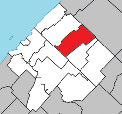 Location within Les Basques RCM | |
 Lac-Boisbouscache Location in eastern Quebec | |
| Coordinates: 48°08′N 68°50′W / 48.133°N 68.833°WCoordinates: 48°08′N 68°50′W / 48.133°N 68.833°W[1] | |
| Country | |
| Province | |
| Region | Bas-Saint-Laurent |
| RCM | Les Basques |
| Government | |
| • Federal riding | Montmagny—L'Islet— Kamouraska—Rivière-du-Loup |
| • Prov. riding | Côte-du-Sud |
| Area | |
| • Total | 101.80 km2 (39.31 sq mi) |
| • Land | 99.39 km2 (38.37 sq mi) |
| Population | |
| • Total | 0 |
| • Density | 0/km2 (0/sq mi) |
| • Pop 2006-2011 | |
| • Dwellings | 17 |
| Time zone | UTC−5 (EST) |
| • Summer (DST) | UTC−4 (EDT) |
| Highways | No major routes |

Lac-Boisbouscache is an unorganized territory in the Canadian province of Quebec, located in the Les Basques Regional County Municipality.
Demographics[]
Population[]
| Year | Pop. | ±% |
|---|---|---|
| 1991 | 0 | — |
| 1996 | 0 | 0.00% |
| 2001 | 0 | 0.00% |
| 2006 | 0 | 0.00% |
| 2011 | 0 | 0.00% |
See also[]
References[]
- ^ Reference number 149452 of the Commission de toponymie du Québec (in French)
- ^ a b Geographic code 11902 in the official Répertoire des municipalités (in French)
- ^ a b "(Code 2411902) Census Profile". 2011 census. Statistics Canada. 2012.
- ^ Statistics Canada: 1996, 2001, 2006, 2011 census
Adjacent Municipal Subdivisions | ||||||||||||||||
|---|---|---|---|---|---|---|---|---|---|---|---|---|---|---|---|---|
| ||||||||||||||||
| Cities & Towns | |
|---|---|
| Municipalities |
|
| Parishes | |
| Unorganized territories | |
| |
This Bas-Saint-Laurent location article is a stub. You can help Wikipedia by . |
Categories:
- Incorporated places in Bas-Saint-Laurent
- Bas-Saint-Laurent geography stubs