Saint-Eugène-de-Ladrière, Quebec
Saint-Eugène-de-Ladrière | |
|---|---|
Parish municipality | |
 | |
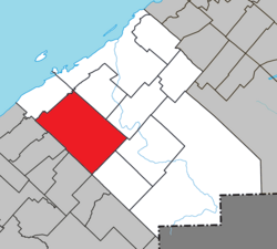 Location within Rimouski-Neigette RCM | |
 Saint-Eugène-de-Ladrière Location in eastern Quebec | |
| Coordinates: 48°15′N 68°48′W / 48.25°N 68.8°WCoordinates: 48°15′N 68°48′W / 48.25°N 68.8°W[1] | |
| Country | |
| Province | |
| Region | Bas-Saint-Laurent |
| RCM | Rimouski-Neigette |
| Constituted | January 1, 1962 |
| Government | |
| • Mayor | Gilbert Pigeon |
| • Federal riding | Rimouski-Neigette—Témiscouata—Les Basques |
| • Prov. riding | Rimouski |
| Area | |
| • Total | 354.30 km2 (136.80 sq mi) |
| • Land | 335.56 km2 (129.56 sq mi) |
| Population (2011)[3] | |
| • Total | 421 |
| • Density | 1.3/km2 (3/sq mi) |
| • Pop 2006-2011 | |
| • Dwellings | 185 |
| Time zone | UTC−5 (EST) |
| • Summer (DST) | UTC−4 (EDT) |
| Postal code(s) | G0L 1P0 |
| Area code(s) | 418 and 581 |
| Highways | No major routes |
| Website | www |

Saint-Eugène-de-Ladrière is a parish municipality in the Rimouski-Neigette Regional County Municipality in the Bas-Saint-Laurent region of Quebec, Canada.
On July 6, 2002, unorganized territory Grand-Lac-Touradi was annexed by Saint-Eugène-de-Ladrière.[4]
See also[]
References[]
- ^ Reference number 56472 of the Commission de toponymie du Québec (in French)
- ^ Jump up to: a b Geographic code 10075 in the official Répertoire des municipalités (in French)
- ^ Jump up to: a b "(Code 2410075) Census Profile". 2011 census. Statistics Canada. 2012.
- ^ "Modifications aux municipalités du Québec" (PDF). Institut de la Statistiques du Québec. July 2002. Retrieved 2012-08-14.[permanent dead link]
External links[]
 Media related to Saint-Eugène-de-Ladrière at Wikimedia Commons
| show Adjacent Municipal Subdivisions |
|---|
| hide | |
|---|---|
| Cities & Towns | |
| Municipalities | |
| Parishes | |
| Unorganized territories | |
| |
| show Authority control |
|---|
This Bas-Saint-Laurent location article is a stub. You can help Wikipedia by . |
Categories:
- Parish municipalities in Quebec
- Incorporated places in Bas-Saint-Laurent
- Bas-Saint-Laurent geography stubs