Esprit-Saint, Quebec
Esprit-Saint | |
|---|---|
Municipality | |
 | |
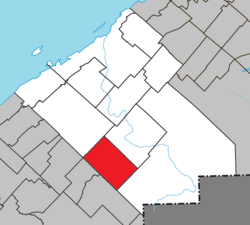 Location within Rimouski-Neigette RCM | |
 Esprit-Saint Location in eastern Quebec | |
| Coordinates: 48°04′00″N 68°34′00″W / 48.0667°N 68.5667°WCoordinates: 48°04′00″N 68°34′00″W / 48.0667°N 68.5667°W[1] | |
| Country | |
| Province | |
| Region | Bas-Saint-Laurent |
| RCM | Rimouski-Neigette |
| Constituted | May 13, 1972 |
| Government | |
| • Mayor | Marlène Dubé |
| • Federal riding | Rimouski-Neigette—Témiscouata—Les Basques |
| • Prov. riding | Rimouski |
| Area | |
| • Total | 169.40 km2 (65.41 sq mi) |
| • Land | 168.96 km2 (65.24 sq mi) |
| Population (2011)[3] | |
| • Total | 379 |
| • Density | 2.2/km2 (6/sq mi) |
| • Pop 2006-2011 | |
| • Dwellings | 177 |
| Time zone | UTC−5 (EST) |
| • Summer (DST) | UTC−4 (EDT) |
| Postal code(s) | G0K 1A0 |
| Area code(s) | 418 and 581 |
| Highways | |
| Website | www |

Esprit-Saint is a municipality in Rimouski-Neigette Regional County Municipality in the Bas-Saint-Laurent region of Quebec, Canada. Its population as of the Canada 2011 Census was 379.
See also[]
References[]
- ^ Reference number 21393 of the Commission de toponymie du Québec (in French)
- ^ Jump up to: a b Geographic code 10005 in the official Répertoire des municipalités (in French)
- ^ Jump up to: a b "(Code 2410005) Census Profile". 2011 census. Statistics Canada. 2012.
External links[]
![]() Media related to Esprit-Saint at Wikimedia Commons
Media related to Esprit-Saint at Wikimedia Commons
| show Adjacent Municipal Subdivisions |
|---|
| hide | |
|---|---|
| Cities & Towns | |
| Municipalities | |
| Parishes | |
| Unorganized territories | |
| |
| Authority control |
|
|---|
This Quebec location article is a stub. You can help Wikipedia by . |
Categories:
- Municipalities in Quebec
- Incorporated places in Bas-Saint-Laurent
- Quebec geography stubs