Sainte-Rita, Quebec
Sainte-Rita | |
|---|---|
Municipality | |
 | |
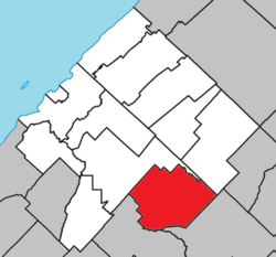 Location within Les Basques RCM | |
 Sainte-Rita Location in eastern Quebec | |
| Coordinates: 47°57′00″N 68°55′00″W / 47.95°N 68.9167°WCoordinates: 47°57′00″N 68°55′00″W / 47.95°N 68.9167°W[1] | |
| Country | |
| Province | |
| Region | Bas-Saint-Laurent |
| RCM | Les Basques |
| Constituted | January 1, 1948 |
| Government | |
| • Mayor | Michel Colpron |
| • Federal riding | Rimouski-Neigette—Témiscouata —Les Basques |
| • Prov. riding | Rivière-du-Loup-Témiscouata |
| Area | |
| • Total | 131.60 km2 (50.81 sq mi) |
| • Land | 129.84 km2 (50.13 sq mi) |
| Population | |
| • Total | 313 |
| • Density | 2.4/km2 (6/sq mi) |
| • Pop 2006-2011 | |
| • Dwellings | 164 |
| Time zone | UTC−5 (EST) |
| • Summer (DST) | UTC−4 (EDT) |
| Postal code(s) | G0L 4G0 |
| Area code(s) | 418 and 581 |
| Highways | |
| Website | www.municipalite. sainte-rita.qc.ca |

Sainte-Rita is a municipality in Quebec, Canada.
Demographics[]
Population[]
| hideCanada census – Sainte-Rita, Quebec community profile | |||
|---|---|---|---|
| 2011 | 2006 | ||
| Population: | 313 (-11.8% from 2006) | 355 (-8.5% from 2001) | |
| Land area: | 129.84 km2 (50.13 sq mi) | 129.84 km2 (50.13 sq mi) | |
| Population density: | 2.4/km2 (6.2/sq mi) | 2.7/km2 (7.0/sq mi) | |
| Median age: | 49.8 (M: 49.4, F: 50.5) | 44.7 (M: 44.8, F: 44.5) | |
| Total private dwellings: | 164 | 219 | |
| Median household income: | $37,483 | $28,483 | |
| References: 2011[4] 2006[5] earlier[6] | |||
| Year | Pop. | ±% |
|---|---|---|
| 1991 | 402 | — |
| 1996 | 387 | −3.7% |
| 2001 | 388 | +0.3% |
| 2006 | 355 | −8.5% |
| 2011 | 313 | −11.8% |
Language[]
| Canada Census Mother Tongue - Sainte-Rita, Quebec[7] | ||||||||||||||||||
|---|---|---|---|---|---|---|---|---|---|---|---|---|---|---|---|---|---|---|
| Census | Total | French
|
English
|
French & English
|
Other
| |||||||||||||
| Year | Responses | Count | Trend | Pop % | Count | Trend | Pop % | Count | Trend | Pop % | Count | Trend | Pop % | |||||
2011
|
310
|
310 | 100.00% | 0 | 0.00% | 0 | 0.00% | 0 | 0.00% | |||||||||
2006
|
350
|
350 | 100.00% | 0 | 0.00% | 0 | 0.00% | 0 | 0.00% | |||||||||
2001
|
360
|
360 | 100.00% | 0 | 0.00% | 0 | 0.00% | 0 | 0.00% | |||||||||
1996
|
365
|
355 | n/a | 97.26% | 10 | n/a | 2.74% | 0 | n/a | 0.00% | 0 | n/a | 0.00% | |||||
See also[]
References[]
- ^ Reference number 56376 of the Commission de toponymie du Québec (in French)
- ^ Jump up to: a b Geographic code 11015 in the official Répertoire des municipalités (in French)
- ^ Jump up to: a b "(Code 2411015) Census Profile". 2011 census. Statistics Canada. 2012.
- ^ "2011 Community Profiles". 2011 Canadian Census. Statistics Canada. July 5, 2013. Retrieved 2014-03-10.
- ^ "2006 Community Profiles". 2006 Canadian Census. Statistics Canada. March 30, 2011. Retrieved 2014-03-10.
- ^ "2001 Community Profiles". 2001 Canadian Census. Statistics Canada. February 17, 2012.
- ^ Jump up to: a b Statistics Canada: 1996, 2001, 2006, 2011 census
External links[]
 Media related to Sainte-Rita at Wikimedia Commons
| show Adjacent Municipal Subdivisions |
|---|
| hide | |
|---|---|
| Cities & Towns | |
| Municipalities |
|
| Parishes | |
| Unorganized territories | |
| |
| show Authority control |
|---|
This Quebec location article is a stub. You can help Wikipedia by . |
Categories:
- Municipalities in Quebec
- Incorporated places in Bas-Saint-Laurent
- Quebec geography stubs