Sainte-Perpétue, Quebec (parish)
Sainte-Perpétue | |
|---|---|
Parish municipality | |
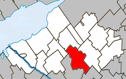 Location within Nicolet-Yamaska RCM. | |
 Sainte-Perpétue Location in southern Quebec. | |
| Coordinates: 46°05′N 72°28′W / 46.083°N 72.467°WCoordinates: 46°05′N 72°28′W / 46.083°N 72.467°W[1] | |
| Country | |
| Province | |
| Region | Centre-du-Québec |
| RCM | Nicolet-Yamaska |
| Constituted | March 9, 1878 |
| Government | |
| • Mayor | Line Théroux |
| • Federal riding | Bas-Richelieu— Nicolet—Bécancour |
| • Prov. riding | Nicolet-Bécancour |
| Area | |
| • Total | 71.70 km2 (27.68 sq mi) |
| • Land | 71.46 km2 (27.59 sq mi) |
| Population | |
| • Total | 983 |
| • Density | 13.8/km2 (36/sq mi) |
| • Pop 2006-2011 | |
| • Dwellings | 376 |
| Time zone | UTC−5 (EST) |
| • Summer (DST) | UTC−4 (EDT) |
| Postal code(s) | J0C 1R0 |
| Area code(s) | 819 |
| Highways | |

Sainte-Perpétue is a parish municipality in the Centre-du-Québec region of Quebec, Canada, situated along Route 259. The population as of the Canada 2011 Census was 983.
Demographics[]
Population[]Population trend:[5]
|
Language[]Mother tongue language (2006)[6]
|
Attractions[]
A primarily agricultural area, Sainte-Perpétue is best known throughout the province of Quebec for its Festival du cochon (Pig festival), featuring, among other things, several days of live music, a human-versus-pig mud wrestling competition, and a boar catching competition.
See also[]
References[]
- ^ Reference number 56362 of the Commission de toponymie du Québec (in French)
- ^ Jump up to: a b Ministère des Affaires municipales, des Régions et de l'Occupation du territoire: Sainte-Perpétue (Centre-du-Québec)
- ^ Parliament of Canada Federal Riding History: BAS-RICHELIEU--NICOLET--BÉCANCOUR (Quebec)
- ^ Jump up to: a b 2011 Statistics Canada Census Profile: Sainte-Perpétue (Centre-du-Québec), Quebec
- ^ Statistics Canada: 1996, 2001, 2006, 2011 census
- ^ 2006 Statistics Canada Community Profile: Sainte-Perpétue (Centre-du-Québec), Quebec
External links[]
| show Adjacent Municipal Subdivisions |
|---|
| hide | |
|---|---|
| Cities | |
| Municipalities | |
| Parishes | |
| Villages | |
| |
Categories:
- Parish municipalities in Quebec
- Incorporated places in Centre-du-Québec
- Nicolet-Yamaska Regional County Municipality