Sainte-Ursule, Quebec
Sainte-Ursule | |
|---|---|
Municipality | |
 Sainte-Ursule Falls | |
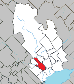 Location within Maskinongé RCM. | |
 Sainte-Ursule Location in central Quebec. | |
| Coordinates: 46°17′N 73°02′W / 46.283°N 73.033°WCoordinates: 46°17′N 73°02′W / 46.283°N 73.033°W[1] | |
| Country | |
| Province | |
| Region | Mauricie |
| RCM | Maskinongé |
| Constituted | July 1, 1855 |
| Government | |
| • Mayor | Réjean Carle |
| • Federal riding | Berthier—Maskinongé |
| • Prov. riding | Maskinongé |
| Area | |
| • Total | 68.20 km2 (26.33 sq mi) |
| • Land | 67.91 km2 (26.22 sq mi) |
| Population (2011)[3] | |
| • Total | 1,375 |
| • Density | 20.2/km2 (52/sq mi) |
| • Pop 2006-2011 | |
| • Dwellings | 682 |
| Time zone | UTC−5 (EST) |
| • Summer (DST) | UTC−4 (EDT) |
| Postal code(s) | J0K 3M0 |
| Area code(s) | 819 |
| Highways | |
| Website | www |

Sainte-Ursule is a municipality in the Mauricie region of the province of Quebec in Canada.
References[]
- ^ Reference number 433865 of the Commission de toponymie du Québec (in French)
- ^ Jump up to: a b Geographic code 51040 in the official Répertoire des municipalités (in French)
- ^ Jump up to: a b "(Code 2451040) Census Profile". 2016 census. Statistics Canada. 2017.
| show Places adjacent to Sainte-Ursule, Quebec |
|---|
| hide | |
|---|---|
| Cities & towns | |
| Municipalities | |
| Parishes | |
| |
| show Authority control |
|---|
This Quebec location article is a stub. You can help Wikipedia by . |
Categories:
- Municipalities in Quebec
- Incorporated places in Mauricie
- Quebec geography stubs