Maskinongé, Quebec
show This article may be expanded with text translated from the corresponding article in French. (August 2015) Click [show] for important translation instructions. |
Maskinongé | |
|---|---|
Municipality | |
 | |
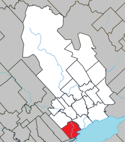 Location within Maskinongé RCM. | |
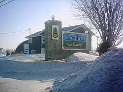
 Maskinongé Location in central Quebec. | |
| Coordinates: 46°14′N 73°01′W / 46.233°N 73.017°WCoordinates: 46°14′N 73°01′W / 46.233°N 73.017°W[1] | |
| Country | |
| Province | |
| Region | Mauricie |
| RCM | Maskinongé |
| Constituted | April 25, 2001 |
| Government | |
| • Mayor | Roger Michaud |
| • Federal riding | Berthier—Maskinongé |
| • Prov. riding | Maskinongé |
| Area | |
| • Total | 74.40 km2 (28.73 sq mi) |
| • Land | 74.55 km2 (28.78 sq mi) |
| There is an apparent contradiction between two authoritative sources | |
| Population (2011)[3] | |
| • Total | 2,253 |
| • Density | 30.2/km2 (78/sq mi) |
| • Pop 2006-2011 | |
| • Dwellings | 1,093 |
| Time zone | UTC−5 (EST) |
| • Summer (DST) | UTC−4 (EDT) |
| Postal code(s) | J0K 1N0 |
| Area code(s) | 819 |
| Highways | |
| Website | www |

Maskinongé is a municipality in the Mauricie region of the province of Quebec in Canada.
References[]
- ^ Reference number 367126 of the Commission de toponymie du Québec (in French)
- ^ Jump up to: a b Geographic code 51008 in the official Répertoire des municipalités (in French)
- ^ Jump up to: a b "(Code 2451008) Census Profile". 2011 census. Statistics Canada. 2012.
External links[]
 Media related to Maskinongé, Quebec at Wikimedia Commons
| show Places adjacent to Maskinongé, Quebec |
|---|
| hide | |
|---|---|
| Cities & towns | |
| Municipalities | |
| Parishes | |
| |
| show Authority control |
|---|
This Quebec location article is a stub. You can help Wikipedia by . |
Categories:
- Incorporated places in Mauricie
- Municipalities in Quebec
- Quebec geography stubs