Sainte-Geneviève-de-Berthier, Quebec
Sainte-Geneviève-de-Berthier | |
|---|---|
Municipality | |
 | |
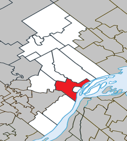 Location within D'Autray RCM | |
 Sainte-Geneviève-de-Berthier Location in central Quebec | |
| Coordinates: 46°05′N 73°13′W / 46.083°N 73.217°WCoordinates: 46°05′N 73°13′W / 46.083°N 73.217°W[1] | |
| Country | Canada |
| Province | Quebec |
| Region | Lanaudière |
| RCM | D'Autray |
| Constituted | July 1, 1855 |
| Government | |
| • Mayor | Richard Giroux |
| • Federal riding | Berthier—Maskinongé |
| • Prov. riding | Berthier |
| Area | |
| • Total | 73.20 km2 (28.26 sq mi) |
| • Land | 66.69 km2 (25.75 sq mi) |
| Population (2011)[3] | |
| • Total | 2,365 |
| • Density | 35.5/km2 (92/sq mi) |
| • Pop 2006-2011 | |
| • Dwellings | 962 |
| Time zone | UTC−5 (EST) |
| • Summer (DST) | UTC−4 (EDT) |
| Postal code(s) | J0K 1A0 |
| Area code(s) | 450 and 579 |
| Highways | |

Sainte-Geneviève-de-Berthier is a municipality in the Lanaudière region of Quebec, Canada, part of the D'Autray Regional County Municipality.
Demographics[]
Population trend:[4]
- Population in 2011: 2365 (2006 to 2011 population change: 2.5%)
- Population in 2006: 2307
- Population in 2001: 2387
- Population in 1996: 2402
- Population in 1991: 2263
Private dwellings occupied by usual residents: 949 (total dwellings: 962)
Mother tongue:
- English as first language: 0.7%
- French as first language: 96.7%
- English and French as first language: 0%
- Other as first language: 2.6%
Education[]
This section needs expansion. You can help by . (September 2017) |
The Sir Wilfrid Laurier School Board operates anglophone public schools, including:
- Joliette Elementary School in Saint-Charles-Borromée[5]
- Joliette High School in Joliette[6]
See also[]
References[]
- ^ Reference number 417963 of the Commission de toponymie du Québec (in French)
- ^ Jump up to: a b Geographic code 52040 in the official Répertoire des municipalités (in French)
- ^ Jump up to: a b Statistics Canada 2011 Census - Sainte-Geneviève-de-Berthier census profile
- ^ Statistics Canada: 1996, 2001, 2006, 2011 census
- ^ "JOLIETTE ELEMENTARY ZONE." Sir Wilfrid Laurier School Board. Retrieved on September 17, 2017.
- ^ "Joliette High School Zone Sec 1-5." Sir Wilfrid Laurier School Board. Retrieved on September 5, 2017.
External links[]
![]() Media related to Sainte-Geneviève-de-Berthier at Wikimedia Commons
Media related to Sainte-Geneviève-de-Berthier at Wikimedia Commons
| show Adjacent Municipal Subdivisions |
|---|
| hide | |
|---|---|
| Cities & Towns | |
| Municipalities | |
| Parishes | |
| |
| Authority control |
|
|---|
This Quebec location article is a stub. You can help Wikipedia by . |
Categories:
- Incorporated places in Lanaudière
- Municipalities in Quebec
- Quebec geography stubs