Salem Township, Washington County, Ohio
Salem Township, Washington County, Ohio | |
|---|---|
 Warner Community Church | |
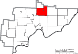 Location of Salem Township in Washington County | |
| Coordinates: 39°33′14″N 81°24′31″W / 39.55389°N 81.40861°WCoordinates: 39°33′14″N 81°24′31″W / 39.55389°N 81.40861°W | |
| Country | United States |
| State | Ohio |
| County | Washington |
| Area | |
| • Total | 27.9 sq mi (72.4 km2) |
| • Land | 27.9 sq mi (72.3 km2) |
| • Water | 0.0 sq mi (0.0 km2) |
| Elevation | 817 ft (249 m) |
| Population (2000) | |
| • Total | 1,130 |
| • Density | 40.5/sq mi (15.6/km2) |
| Time zone | UTC-5 (Eastern (EST)) |
| • Summer (DST) | UTC-4 (EDT) |
| FIPS code | 39-70002[2] |
| GNIS feature ID | 1087143[1] |

Salem Township is one of the twenty-two townships of Washington County, Ohio, United States. The 2000 census found 1,130 people in the township, 1,021 of whom lived in the unincorporated portions of the township.[3]
Geography[]
Located in the northern part of the county, it borders the following townships:
- Jefferson Township, Noble County - north
- Elk Township, Noble County - northeast corner
- Liberty Township - east
- Lawrence Township - southeast corner
- Fearing Township - south
- Muskingum Township - southwest
- Adams Township - west
- Jackson Township, Noble County - northwest corner
- Aurelius Township - northwest, east of Jackson Township
The village of Lower Salem is located in central Lower Salem Township, and the unincorporated community of Whipple lies in the township's south.
Name and history[]
It is one of fourteen Salem Townships statewide.[4]
In 1833, Salem Township contained a meeting house, store, and a steam saw mill.[5]
Government[]
The township is governed by a three-member board of trustees, who are elected in November of odd-numbered years to a four-year term beginning on the following January 1. Two are elected in the year after the presidential election and one is elected in the year before it. There is also an elected township fiscal officer,[6] who serves a four-year term beginning on April 1 of the year after the election, which is held in November of the year before the presidential election. Vacancies in the fiscal officership or on the board of trustees are filled by the remaining trustees.
References[]
- ^ a b "US Board on Geographic Names". United States Geological Survey. 2007-10-25. Retrieved 2008-01-31.
- ^ "U.S. Census website". United States Census Bureau. Retrieved 2008-01-31.
- ^ Washington County, Ohio — Population by Places Estimates[permanent dead link] Ohio State University, 2007. Accessed 15 May 2007.
- ^ "Detailed map of Ohio" (PDF). United States Census Bureau. 2000. Retrieved 2007-02-16.
- ^ Kilbourn, John (1833). The Ohio Gazetteer, or, a Topographical Dictionary. Scott and Wright. pp. 403. Retrieved 12 December 2013.
- ^ §503.24, §505.01, and §507.01 of the Ohio Revised Code. Accessed 4/30/2009.
External links[]
Municipalities and communities of Washington County, Ohio, United States | ||
|---|---|---|
| Cities |  | |
| Villages | ||
| Townships | ||
| CDPs | ||
| Unincorporated communities |
| |
| ||
- Townships in Washington County, Ohio
- Townships in Ohio