Sambas Regency
Sambas Regency
Kabupaten Sambas | |
|---|---|
 Coat of arms | |
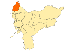 Location within West Kalimantan | |
 Sambas Regency Location in Kalimantan and Indonesia | |
| Coordinates: 1°25′00″N 109°20′00″E / 1.4167°N 109.3333°E | |
| Country | Indonesia |
| Province | West Kalimantan |
| Capital | Sambas |
| Government | |
| • Regent | Atbah Romin Suhaili |
| • Vice Regent | Hairiah |
| Area | |
| • Total | 6,394.70 km2 (2,469.01 sq mi) |
| Population (2020 Census)[1] | |
| • Total | 629,905 |
| • Density | 99/km2 (260/sq mi) |
| Time zone | UTC+7 (IWST) |
| Area code | (+62) |
| Website | sambas.go.id |


Sambas Regency is the most northerly regency in West Kalimantan Province of Indonesia. The regency is one of the original regencies in West Kalimantan. It covers 6,394.70 km2, and had a population of 496,120 at the 2010 Census[2] and 629,905 at the 2020 Census.[3] The principal town lies at Sambas.
History[]
The famous Sambas Treasure, a collection of 9th century Buddhist sculptures, was found near Sambas Town. It is now part of the British Museum's collection.
In the Sambas riots in 1999 Malays and Dayaks joined together to massacre the Madurese during the conflict. Madurese were mutilated, raped, and killed by the Malays and Dayaks and 3,000 of them died in the massacres, with the Indonesian government doing little to stop the violence.[4]
Adjoining Regencies and City[]
| North | Lundu, Malaysia |
| South | Singkawang City, Indonesia |
| West | Natuna Sea, Indonesia |
| East | Bengkayang Regency, Indonesia |
Population[]
At the 2010 Census, Sambas Regency had a population of 496,120, which by the 2020 Census had grown to 629,905 people, with an average density of 98.5 people per km2.
Watershed[]
Sambas has three watersheds (total: 516,200 ha): the Sambas watershed (258,700 ha), the Paloh watershed (64,375 ha), and the Sebangkau watershed (193,125 ha).
Administrative Districts[]
Sambas Regency consists of nineteen districts (kecamatan), tabulated below with their areas and their populations at the 2010 Census[5] and the 2020 Census.[6] The table also includes the number of administrative villages (rural desa and urban kelurahan) in each district, its post code and their administrative centres:
| Name | Area in km2 |
Pop'n Census 2010 |
Pop'n Census 2020 |
No. of vill. |
Post code |
Admin centre |
|---|---|---|---|---|---|---|
| Selakau | 129.51 | 30,072 | 37,810 | 11 | 79452 | Selakau |
| Selakau Timur (East Selakau) |
162.99 | 10,200 | 12,520 | 4 | 79451 | Selakau Tua |
| Pemangkat | 111.00 | 44,589 | 53,250 | 8 | 79455 | Pemangkat |
| Semparuk | 90.15 | 23,765 | 30,180 | 5 | 79457 | Semparuk |
| 82.75 | 14,671 | 18,320 | 5 | 79456 | Salatiga | |
| 395.64 | 63,613 | 80,270 | 23 | 79461 | Tebas | |
| Tekarang | 83.16 | 13,293 | 17,540 | 7 | 79468 | Tekarang |
| Sambas | 246.66 | 44,979 | 57,300 | 18 | 79460 | Sambas (town) |
| 644.55 | 17,527 | 23,760 | 11 | 79417 | Balai Gumuruh | |
| Sebawi | 161.45 | 15,598 | 20,250 | 7 | 79464 | Sebawi |
| 94.94 | 9,936 | 13,640 | 4 | 79462 | Tengguli | |
| 193.99 | 35,042 | 47,310 | 13 | 79454 | Sentebang | |
| Jawai Selatan (South Jawai) |
93.51 | 17,660 | 22,170 | 9 | 79154 | Matang Terap |
| Teluk Keramat (Keramat Bay) |
554.43 | 58,675 | 74,180 | 25 | 79469 | Sekura |
| Galing | 333.00 | 19,653 | 24,860 | 10 | 79453 | Galing |
| Tangaran | 186.67 | 20,789 | 25,840 | 8 | 79465 | Simpang Empat |
| Sejangkang | 291.26 | 22,318 | 27,540 | 12 | 79463 | Sejangkang |
| Sajingan Besar (Great Sajingan) |
1,391.20 | 9,848 | 13,290 | 5 | 79467 | Kaliau' |
| Paloh | 1,148.84 | 23,892 | 29,900 | 8 | 79466 | Liku |
| Totals | 6,394.70 | 496,120 | 629,905 | 193 |
List of Sambas Regents and Vice Regents[]
References[]
- ^ Badan Pusat Statistik, Jakarta, 2021.
- ^ Biro Pusat Statistik, Jakarta, 2011.
- ^ Badan Pusat Statistik, Jakarta, 2021.
- ^ http://news.bbc.co.uk/2/hi/world/asia-pacific/1186401.stm http://www.culturalsurvival.org/ourpublications/csq/article/violence-indonesian-borneo-spurs-relocation-ethnic-madurese http://indahnesia.com/indonesia/SAMPEO/people.php https://books.google.com/books?id=OrdM8X7CBTAC&pg=PA299&lpg=PA299&dq=dayaks+malay+madurese&source=bl&ots=uZeyxBWjTh&sig=HJgReO2XzQEeybz5g8k2mMqTKXk&hl=en&sa=X&ei=e8_vUpXQJqvJsQTvt4GYDA&ved=0CCsQ6AEwAg#v=onepage&q=dayaks%20malay%20madurese&f=false https://books.google.com/books?id=EUDii8kvQYAC&pg=PA73#v=onepage&q&f=false
- ^ Biro Pusat Statistik, Jakarta, 2011.
- ^ Badan Pusat Statistik, Jakarta, 20201.
External links[]
- General Condition of Sambas Regency - Official Site of Sambas Regency
- The Regent of Sambas Regency - Official Site of Sambas Regency
- The Vice Regent of Sambas Regency - Official Site of Sambas Regency
| show Regencies and cities of West Kalimantan |
|---|
| show Authority control |
|---|
- Regencies of West Kalimantan