Sangamon Valley Township, Cass County, Illinois
Sangamon Valley Township | |
|---|---|
 Location in Cass County | |
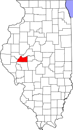 Cass County's location in Illinois | |
| Coordinates: 40°00′34″N 90°12′53″W / 40.00944°N 90.21472°WCoordinates: 40°00′34″N 90°12′53″W / 40.00944°N 90.21472°W | |
| Country | United States |
| State | Illinois |
| County | Cass |
| Established | November 6, 1923 |
| Area | |
| • Total | 39.81 sq mi (103.1 km2) |
| • Land | 39.71 sq mi (102.8 km2) |
| • Water | 0.1 sq mi (0.3 km2) 0.25% |
| Elevation | 620 ft (189 m) |
| Population (2010) | |
| • Estimate (2016)[1] | 309 |
| • Density | 8.3/sq mi (3.2/km2) |
| Time zone | UTC-6 (CST) |
| • Summer (DST) | UTC-5 (CDT) |
| ZIP codes | 62618, 62627, 62691 |
| FIPS code | 17-017-67600 |

Sangamon Valley Township is one of eleven townships in Cass County, Illinois, USA. As of the 2010 census, its population was 328 and it contained 191 housing units.[2]
Geography[]
According to the 2010 census, the township has a total area of 39.81 square miles (103.1 km2), of which 39.71 square miles (102.8 km2) (or 99.75%) is land and 0.1 square miles (0.26 km2) (or 0.25%) is water.[2]
Cities, towns, villages[]
- Chandlerville (west edge)
- Virginia (north edge)
Unincorporated towns[]
(This list is based on USGS data and may include former settlements.)
Cemeteries[]
The township contains these three cemeteries: Cauby, Powell and Walnut Ridge.
Major highways[]
Rivers[]
Lakes[]
- Cottonwood Lake
Landmarks[]
- Panther Creek Conservation Area (west three-quarters)
- Panther Creek State Wildlife Refuge
Demographics[]
| Historical population | |||
|---|---|---|---|
| Census | Pop. | %± | |
| 2016 (est.) | 309 | [1] | |
| U.S. Decennial Census[3] | |||
School districts[]
- A C Central Community Unit School District 262
- Beardstown Community Unit School District 15
- Virginia Community Unit School District 64
Political districts[]
- Illinois' 18th congressional district
- State House District 93
- State Senate District 47
References[]
- "Sangamon Valley Township, Cass County, Illinois". Geographic Names Information System. United States Geological Survey. Retrieved 2010-01-04.
- United States Census Bureau 2007 TIGER/Line Shapefiles
- United States National Atlas
- ^ Jump up to: a b "Population and Housing Unit Estimates". Retrieved June 9, 2017.
- ^ Jump up to: a b "Population, Housing Units, Area, and Density: 2010 - County -- County Subdivision and Place -- 2010 Census Summary File 1". United States Census. Archived from the original on 2020-02-12. Retrieved 2013-05-28.
- ^ "Census of Population and Housing". Census.gov. Retrieved June 4, 2016.
External links[]
| show Places adjacent to Sangamon Valley Township, Cass County, Illinois |
|---|
| show Municipalities and communities of Cass County, Illinois, United States |
|---|
| show Authority control |
|---|
Categories:
- Townships in Cass County, Illinois
- Townships in Illinois
- 1923 establishments in Illinois