Cass County, Illinois
Cass County | |
|---|---|
U.S. county | |
 | |
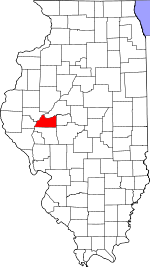 Location within the U.S. state of Illinois | |
 Illinois's location within the U.S. | |
| Coordinates: 39°59′N 90°15′W / 39.98°N 90.25°W | |
| Country | |
| State | |
| Founded | 1837 |
| Named for | Lewis Cass |
| Seat | Virginia |
| Largest city | Beardstown |
| Area | |
| • Total | 384 sq mi (990 km2) |
| • Land | 376 sq mi (970 km2) |
| • Water | 7.9 sq mi (20 km2) 2.1% |
| Population (2010) | |
| • Total | 13,642 |
| • Estimate (2019) | 12,147 |
| • Density | 36/sq mi (14/km2) |
| Time zone | UTC−6 (Central) |
| • Summer (DST) | UTC−5 (CDT) |
| Congressional district | 18th |
| Website | co |

Cass County is a county located in the U.S. state of Illinois. As of the 2010 United States Census, the population was 13,642.[1] Its county seat is Virginia.[2] It is the home of the Jim Edgar Panther Creek State Fish and Wildlife Area.
History[]
Cass County was formed in 1837 out of Morgan County. It was named for Lewis Cass,[3] a general in the War of 1812, Governor of the Michigan Territory, and United States Secretary of State in 1860. Cass was serving as Andrew Jackson's Secretary of War just before the County was named.

Cass County at the time of its creation.

In 1845, the county's border was adjusted southward, enlarging it to its current size.


Geography[]
According to the US Census Bureau, the county has a total area of 384 square miles (990 km2), of which 376 square miles (970 km2) is land and 7.9 square miles (20 km2) (2.1%) is water.[4]
Adjacent counties[]
- Mason County - northeast
- Menard County - east
- Sangamon County - southeast
- Morgan County - south
- Brown County - west
- Schuyler County - northwest
National protected area[]
Rivers[]
- Illinois River
- Little Sangamon River[5]
- Sangamon River
Major highways[]
 US Route 67
 Illinois Route 78
 Illinois Route 100
 Illinois Route 125
Climate and weather[]
| Virginia, Illinois | ||||||||||||||||||||||||||||||||||||||||||||||||||||||||||||
|---|---|---|---|---|---|---|---|---|---|---|---|---|---|---|---|---|---|---|---|---|---|---|---|---|---|---|---|---|---|---|---|---|---|---|---|---|---|---|---|---|---|---|---|---|---|---|---|---|---|---|---|---|---|---|---|---|---|---|---|---|
| Climate chart (explanation) | ||||||||||||||||||||||||||||||||||||||||||||||||||||||||||||
| ||||||||||||||||||||||||||||||||||||||||||||||||||||||||||||
| ||||||||||||||||||||||||||||||||||||||||||||||||||||||||||||
In recent years, average temperatures in the county seat of Virginia have ranged from a low of 15 °F (−9 °C) in January to a high of 87 °F (31 °C) in July, although a record low of −28 °F (−33 °C) was recorded in February 1934 and a record high of 114 °F (46 °C) was recorded in July 1954. Average monthly precipitation ranged from 1.35 inches (34 mm) in January to 4.86 inches (123 mm) in May.[6]
Demographics[]
| Historical population | |||
|---|---|---|---|
| Census | Pop. | %± | |
| 1840 | 2,981 | — | |
| 1850 | 7,253 | 143.3% | |
| 1860 | 11,325 | 56.1% | |
| 1870 | 11,580 | 2.3% | |
| 1880 | 14,493 | 25.2% | |
| 1890 | 15,963 | 10.1% | |
| 1900 | 17,222 | 7.9% | |
| 1910 | 17,372 | 0.9% | |
| 1920 | 17,896 | 3.0% | |
| 1930 | 16,537 | −7.6% | |
| 1940 | 16,425 | −0.7% | |
| 1950 | 15,097 | −8.1% | |
| 1960 | 14,539 | −3.7% | |
| 1970 | 14,219 | −2.2% | |
| 1980 | 15,084 | 6.1% | |
| 1990 | 13,437 | −10.9% | |
| 2000 | 13,695 | 1.9% | |
| 2010 | 13,642 | −0.4% | |
| 2019 (est.) | 12,147 | [7] | −11.0% |
| US Decennial Census[8] 1790-1960[9] 1900-1990[10] 1990-2000[11] 2010-2013[1] | |||

As of the 2010 United States Census, there were 13,642 people, 5,270 households, and 3,561 families residing in the county.[12] The population density was 36.3 inhabitants per square mile (14.0/km2). There were 5,836 housing units at an average density of 15.5 per square mile (6.0/km2).[4] The racial makeup of the county was 86.3% white, 3.1% black or African American, 0.3% Asian, 0.3% American Indian, 8.7% from other races, and 1.4% from two or more races. Those of Hispanic or Latino origin made up 16.8% of the population.[12] In terms of ancestry, 22.6% were German, 21.0% were American, 10.6% were Irish, and 9.5% were English.[13]
Of the 5,270 households, 33.9% had children under the age of 18 living with them, 51.1% were married couples living together, 10.9% had a female householder with no husband present, 32.4% were non-families, and 26.5% of all households were made up of individuals. The average household size was 2.55 and the average family size was 3.06. The median age was 38.7 years.[12]
The median income for a household in the county was $41,544 and the median income for a family was $51,624. Males had a median income of $37,267 versus $26,634 for females. The per capita income for the county was $19,825. About 10.1% of families and 12.9% of the population were below the poverty line, including 14.2% of those under age 18 and 9.2% of those age 65 or over.[14]
Politics[]
Typically for German-settled western Central Illinois, Cass County opposed the Civil War and became solidly Democratic for the next six decades. Only hatred of Woodrow Wilson’s policies towards Germany following World War I drove the county into Republican hands in the 1920 landslide. Between 1924 and 2008, the county was something of a bellwether, missing the national winner only in the very close 1960 election and the heavily drought- and farm crisis-influenced election of 1988. In the 2010s, the county has become powerfully Republican due to opposition to the Democratic Party's social liberalism.[citation needed]
Cass County is located in Illinois's 18th Congressional District and is currently represented by Republican Davin LaHood. For the Illinois House of Representatives, the county is located in the 93rd district and is currently represented by Republican Norine Hammond. The county is located in the 47th district of the Illinois Senate, and is currently represented by Republican Jil Tracy.
Education[]
- A C Central Community Unit School District 262
- Beardstown Community Unit School District 15
- Porta Community Unit School District 202
- Triopia Community Unit School District 27
- Virginia Community Unit School District 64
Communities[]
Cities[]
- Beardstown
- Virginia (seat)
Villages[]
Unincorporated communities[]
Former communities[]
- Gurney
- Oak Grove (now part of Beardstown; not to be confused with community in Rock Island County)
- Sylvan
Townships[]
See also[]
- National Register of Historic Places listings in Cass County, Illinois
References[]
- ^ Jump up to: a b "State & County QuickFacts". US Census Bureau. Archived from the original on July 8, 2011. Retrieved July 4, 2014.
- ^ "Find a County". National Association of Counties. Archived from the original on May 31, 2011. Retrieved June 7, 2011.
- ^ Gannett, Henry (1905). The Origin of Certain Place Names in the United States. Govt. Print. Off. p. 71.
- ^ Jump up to: a b "Population, Housing Units, Area, and Density: 2010 - County". US Census Bureau. Archived from the original on February 12, 2020. Retrieved July 11, 2015.
- ^ Little Sangamon River, Cass County IL Google Maps (accessed 28 December 2018)
- ^ Jump up to: a b "Monthly Averages for Virginia IL". The Weather Channel. Retrieved January 27, 2011.
- ^ "County Population Totals: 2010-2019". Retrieved March 3, 2021.
- ^ "US Decennial Census". US Census Bureau. Retrieved July 4, 2014.
- ^ "Historical Census Browser". University of Virginia Library. Retrieved July 4, 2014.
- ^ "Population of Counties by Decennial Census: 1900 to 1990". US Census Bureau. Retrieved July 4, 2014.
- ^ "Census 2000 PHC-T-4. Ranking Tables for Counties: 1990 and 2000" (PDF). US Census Bureau. Retrieved July 4, 2014.
- ^ Jump up to: a b c "Profile of General Population and Housing Characteristics: 2010 Demographic Profile Data". US Census Bureau. Archived from the original on February 13, 2020. Retrieved July 11, 2015.
- ^ "Selected Social Characteristics in the United States – 2006-2010 American Community Survey 5-Year Estimates". US Census Bureau. Archived from the original on February 13, 2020. Retrieved July 11, 2015.
- ^ "Selected Economic Characteristics – 2006-2010 American Community Survey 5-Year Estimates". US Census Bureau. Archived from the original on February 13, 2020. Retrieved July 11, 2015.
- ^ Leip, David. "Atlas of US Presidential Elections". uselectionatlas.org. Retrieved October 30, 2018.
External links[]
- Official website

- US Census Bureau 2007 TIGER/Line Shapefiles
- US Board on Geographic Names (GNIS)
- US National Atlas
| show Places adjacent to Cass County, Illinois |
|---|
| show Municipalities and communities of Cass County, Illinois, United States |
|---|

| show Authority control |
|---|
- Illinois counties
- Cass County, Illinois
- 1837 establishments in Illinois
- Populated places established in 1837