Sanshui District
Sanshui
三水区 | |
|---|---|
District | |
 Sanshuibei railway station | |
 | |
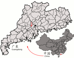 Location of Sanshui District (red) in Foshan City and Guangdong | |
| Coordinates: 23°09′21″N 112°53′48″E / 23.15583°N 112.89667°ECoordinates: 23°09′21″N 112°53′48″E / 23.15583°N 112.89667°E | |
| Country | People's Republic of China |
| Province | Guangdong |
| Prefecture-level city | Foshan |
| Area | |
| • Total | 874 km2 (337 sq mi) |
| Elevation | 11 m (37 ft) |
| Population (2002) | |
| • Total | 386,000 |
| • Density | 440/km2 (1,100/sq mi) |
| Time zone | UTC+8 (China Standard) |
| Postal code | 528100 |
| Area code | 0757 |
| Licence plate prefix | 粤 ET |
| Website | http://www.sanshui.gov.cn/ |

| Sanshui District | |||||||||||||
|---|---|---|---|---|---|---|---|---|---|---|---|---|---|
| Chinese | 三水 | ||||||||||||
| Jyutping | Saam1-seoi2 | ||||||||||||
| Cantonese Yale | Sāamséui | ||||||||||||
| Hanyu Pinyin | Sānshǔi | ||||||||||||
| Postal | Samshui | ||||||||||||
| Literal meaning | Three Waters Tri-River | ||||||||||||
| |||||||||||||
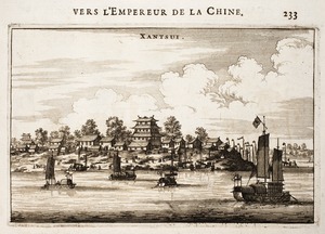
Sanshui District, formerly romanized as Samshui,[a] is an urban district of the prefecture-level city of Foshan in Guangdong province, China. It had about 386,000 inhabitants in 2002. It is known for the "Samsui women", emigrants who labor in Singapore, and for a large fireworks explosion in 2008.
History[]
According to archaeology sites discovered within the region, there were human beings inhabited in the town of Baini (白坭鎮) Sanshui District about four thousand years ago. Samshui was formerly a town which served as the seat of an eponymous county. It was elevated to city status before becoming an urban district of Foshan.
In February 2008, twenty fireworks warehouses exploded in Sanshui. In total over 15,000 cartons of fireworks were set off over a period of 24 hours. The loss of inventory was extensive enough that U.S. markets faced real shortages of supply.
Administration divisions[]
The neighbouring cities, counties and districts are Gaoyao, Dinghu District and Sihui in the west, Qingxin County and Qingyuan in the north, Huadu District and Nanhai District in the east and Gaoming District in the south-west. Sanshui administers 2 subdistricts and 5 towns:[2]
| Name | Chinese (S) | Hanyu Pinyin | Population (2010)[3] | Area (km2) |
|---|---|---|---|---|
| Xinan Subdistrict | 西南街道 | Xīnán Jiēdào | 283,819 | 178.00 |
| 云东海街道 | Yúndōnghǎi Jiēdào | 29,953 | 56.00 | |
| town | 芦苞镇 | Lúbāo Zhèn | 40,626 | 105.00 |
| town | 大塘镇 | Dàtáng Zhèn | 46,704 | 98.23 |
| town | 乐平镇 | Lèpíng Zhèn | 134,508 | 198.50 |
| town | 白坭镇 | Báiní Zhèn | 64,425 | 66.46 |
| town | 南山镇 | Nánshān Zhèn | 22,610 | 115.62 |
Economy[]
Oil, coal, and slate are found in the surrounding area. However, Sanshui is also an important producer of food for Guangdong Province, especially fruit. The mainstay of the former city's economy was the Jianlibao Company, which produced a soft drink made from oranges and honey. During the 1990s, Jianlibao was a popular drink throughout China and it even made it into the Hong Kong market. However, embezzlement by the company's senior management has reduced its success. Despite Sanshui's proximity to Guangzhou and other Pearl River Delta cities, it remains a relatively poor place with many people only earning a few hundred yuan a month.
Transportation[]
Sanshui is on the railway line from Guangzhou to Maoming. The district is served by G15 Shenyang–Haikou Expressway (which provides access to Kaiping and the southern suburbs of Foshan), G55 Erenhot–Guangzhou Expressway (which provides direct access to downtown Guangzhou), China National Highway 321 (which provides access to Zhaoqing) and China National Highway 324.
Climate[]
| Climate data for Sanshui (1981−2010) | |||||||||||||
|---|---|---|---|---|---|---|---|---|---|---|---|---|---|
| Month | Jan | Feb | Mar | Apr | May | Jun | Jul | Aug | Sep | Oct | Nov | Dec | Year |
| Record high °C (°F) | 27.2 (81.0) |
29.0 (84.2) |
32.2 (90.0) |
34.1 (93.4) |
35.5 (95.9) |
37.4 (99.3) |
39.1 (102.4) |
38.7 (101.7) |
37.7 (99.9) |
35.0 (95.0) |
32.7 (90.9) |
28.8 (83.8) |
39.1 (102.4) |
| Average high °C (°F) | 17.6 (63.7) |
17.7 (63.9) |
20.9 (69.6) |
25.6 (78.1) |
29.5 (85.1) |
31.8 (89.2) |
33.3 (91.9) |
33.3 (91.9) |
31.5 (88.7) |
28.6 (83.5) |
24.1 (75.4) |
19.7 (67.5) |
26.1 (79.0) |
| Daily mean °C (°F) | 13.6 (56.5) |
14.3 (57.7) |
17.5 (63.5) |
22.2 (72.0) |
25.8 (78.4) |
28.0 (82.4) |
29.0 (84.2) |
29.1 (84.4) |
27.5 (81.5) |
24.4 (75.9) |
19.6 (67.3) |
15.1 (59.2) |
22.2 (71.9) |
| Average low °C (°F) | 10.6 (51.1) |
11.8 (53.2) |
15.0 (59.0) |
19.7 (67.5) |
23.1 (73.6) |
25.2 (77.4) |
26.0 (78.8) |
26.1 (79.0) |
24.4 (75.9) |
21.1 (70.0) |
16.2 (61.2) |
11.7 (53.1) |
19.2 (66.6) |
| Record low °C (°F) | 1.3 (34.3) |
2.2 (36.0) |
3.1 (37.6) |
8.7 (47.7) |
14.4 (57.9) |
18.5 (65.3) |
21.6 (70.9) |
22.8 (73.0) |
15.8 (60.4) |
10.6 (51.1) |
4.1 (39.4) |
0.3 (32.5) |
0.3 (32.5) |
| Average precipitation mm (inches) | 48.6 (1.91) |
68.3 (2.69) |
100.2 (3.94) |
194.3 (7.65) |
258.9 (10.19) |
279.8 (11.02) |
213.0 (8.39) |
220.5 (8.68) |
169.6 (6.68) |
64.7 (2.55) |
39.5 (1.56) |
31.4 (1.24) |
1,688.8 (66.5) |
| Average relative humidity (%) | 73 | 80 | 83 | 84 | 82 | 83 | 80 | 79 | 77 | 73 | 70 | 68 | 78 |
| Source: China Meteorological Data Service Center | |||||||||||||
Notes[]
References[]
- ^ Baynes, T. S., ed. (1878), , Encyclopædia Britannica, vol. 5 (9th ed.), New York: Charles Scribner's Sons
- ^ 2011年统计用区划代码和城乡划分代码:三水区 (in Simplified Chinese). National Bureau of Statistics of the People's Republic of China. Retrieved 2012-07-23.
- ^ shi, Guo wu yuan ren kou pu cha ban gong; council, Guo jia tong ji ju ren kou he jiu ye tong ji si bian = Tabulation on the 2010 population census of the people's republic of China by township / compiled by Population census office under the state; population, Department of; statistics, employment statistics national bureau of (2012). Zhongguo 2010 nian ren kou pu cha fen xiang, zhen, jie dao zi liao (Di 1 ban. ed.). Beijing Shi: Zhongguo tong ji chu ban she. ISBN 978-7-5037-6660-2.
External links[]
| Wikimedia Commons has media related to Sanshui District. |
- . Encyclopædia Britannica (11th ed.). 1911.
Guangzhou (capital) | |||||||||||||||||||||||||||||||||||||||||||||||||||||||||||||||||||||
| Sub-provincial cities |
| ||||||||||||||||||||||||||||||||||||||||||||||||||||||||||||||||||||
| Prefecture-level cities |
| ||||||||||||||||||||||||||||||||||||||||||||||||||||||||||||||||||||
- Sanshui District