Santadi
Santadi | |
|---|---|
| Comune di Santadi | |
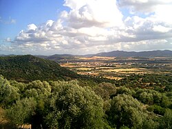 Panorama of Santadi | |
show Location of Santadi | |
 Santadi Location of Santadi in Sardinia | |
| Coordinates: 39°6′N 8°43′E / 39.100°N 8.717°ECoordinates: 39°6′N 8°43′E / 39.100°N 8.717°E | |
| Country | Italy |
| Region | Sardinia |
| Province | South Sardinia |
| Government | |
| • Mayor | Elio Sundas |
| Area | |
| • Total | 115.6 km2 (44.6 sq mi) |
| Elevation | 135 m (443 ft) |
| Population (30 November 2015)[2] | |
| • Total | 3,478 |
| • Density | 30/km2 (78/sq mi) |
| Demonym(s) | Santadesi |
| Time zone | UTC+1 (CET) |
| • Summer (DST) | UTC+2 (CEST) |
| Postal code | 09010 |
| Dialing code | 0781 |
| Website | Official website |


Santadi is a comune (municipality) in the Province of South Sardinia in the Italian region Sardinia, located about 35 kilometres (22 mi) southwest of Cagliari and about 20 kilometres (12 mi) southeast of Carbonia.
Santadi borders the following municipalities: Assemini, Domus de Maria, Nuxis, Piscinas, Pula, Teulada, Villa San Pietro, Villaperuccio.
Starting from a hill next to the small town of Santadi, it is possible to see how the urban development system develops in concentric circles. This fact gave rise to the hypothesis that Santadi is what remains of the capital of the island mentioned by Plato in the third chapter of the Timaeus and in Critias.[3][4]
References[]
| Wikimedia Commons has media related to Santadi. |
- ^ "Popolazione Residente al 1° Gennaio 2018". Istat. Retrieved 16 March 2019.
- ^ All demographics and other statistics: Italian statistical institute Istat.
- ^ Usai, Luigi (2021-03-18). Atlantide è il blocco continentale Sardo-Corso sommerso durante i Meltwater Pulse: Dopo l'ultima glaciazione (in Italian). Independently Published. ISBN 979-8-7238-5624-0.
- ^ Usai, Luigi (2021). La mappa di Atlantide (in Italian) (1 ed.). Quartucciu (CA): Amazon. ISBN 978-3-8482-2822-5.
| Authority control |
|---|
This Sardinia location article is a stub. You can help Wikipedia by . |
Categories:
- Cities and towns in Sardinia
- Municipalities of the Province of South Sardinia
- Sardinia geography stubs