Saran district
Saran district | |
|---|---|
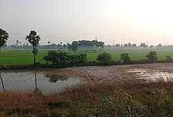 Agricultural field in Saran district | |
 Location of Saran district in Bihar | |
| Coordinates (Chhapra): 25°55′N 84°45′E / 25.917°N 84.750°ECoordinates: 25°55′N 84°45′E / 25.917°N 84.750°E | |
| Country | India |
| State | Bihar |
| Division | Saran |
| Headquarters | Chhapra |
| Tehsils | 20 |
| Government | |
| • Lok Sabha constituencies | 1. Saran, 2. Maharajganj (shared with Siwan district) |
| • Vidhan Sabha constituencies | Ekma, Manjhi, Baniapur, Taraiya, Marhaura, Chapra, Garkha, Amnour, Parsa, Sonpur |
| Area | |
| • Total | 2,641 km2 (1,020 sq mi) |
| Population (2011) | |
| • Total | 3,951,862 |
| • Density | 1,500/km2 (3,900/sq mi) |
| Demographics | |
| • Literacy | 72.57 per cent |
| • Sex ratio | 949 |
| Time zone | UTC+05:30 (IST) |
| Major highways | NH 28B, NH 85, NH 101, NH 102, NH 19 |
| Website | saran |

Saran district is one of the thirty-eight districts of Bihar state, India.[1] The district, part of Saran Division, is also known as Chhapra district after the headquarters of the district, Chhapra.
Typonym[]
It is said that "Saran" is a corrupted version of the word Sarangaranya (forest of Deers). According to legends, earlier it was a dense forest full of Deers and home of Rishi Sarangi. Another suggestion is that the name is corruption of Sakra-aranya (the forest of Indra).[2]
History[]
| Year | Pop. | ±% p.a. |
|---|---|---|
| 1901 | 959,390 | — |
| 1911 | 911,695 | −0.51% |
| 1921 | 931,796 | +0.22% |
| 1931 | 990,147 | +0.61% |
| 1941 | 1,138,986 | +1.41% |
| 1951 | 1,256,306 | +0.99% |
| 1961 | 1,447,297 | +1.43% |
| 1971 | 1,709,722 | +1.68% |
| 1981 | 2,084,322 | +2.00% |
| 1991 | 2,572,980 | +2.13% |
| 2001 | 3,248,701 | +2.36% |
| 2011 | 3,951,862 | +1.98% |
| source:[3] | ||
Chirand, 10 kilometres east of Chhapra, is a stratified Neolithic, Chalcolithic, and Iron Age settlement, which is known for its continuous archaeological record from the Neolithic age (about 2500–1345 BC) to the reign of the Pal dynasty who ruled during the pre-medieval period.[4] The archaeological records suggest transitions in human habitation patterns in Chirand dating from 2500 BC to 30 AD.[5]
Hathwa Raj was a zamindar in the Saran Division of Bihar belonging to Bhumihars, which encompassed 1,365 villages, was inhabited by more than 391,000 people, and produced an annual rental of almost a million rupees.[6]
Hindi version of Saran Gazetteer titled as Srijan was released in September 2016.[7][8][9][10]
Geography[]
Saran district occupies an area of 2,641 square kilometres (1,020 sq mi),[11] equivalent to Drenthe province in the Netherlands.
The district of Saran is situated between 25°36' and 26°13' north latitude and 84°24' and 85°15' east longitude in the southern post of the Saran Division of North Bihar. The Ganges river provides the southern boundary of the district, beyond which lie the districts of Bhojpur and Patna. To the north of Saran lie the districts of Siwan and Gopalganj. The Gandak river forms the dividing line with the Vaishali and Muzaffarpur districts in the east. To the west of Saran lie the districts of Siwan and Balia in Uttar Pradesh. The Ghaghra river forms a natural boundary between Saran and Ballia.
The district is shaped like a triangle; its apex is the confluence of the boundary of the Gopalganj district and the Gandak – Ganges river. The district is made up entirely of plains, but several depressions and marshes create three broad natural divisions:
- The alluvial plains along the big rivers, which are subject to periodic inundation.
- The uplands away from the rivers, not subject to floods.
- The riverbed diara areas.
India's biggest double-decker flyover is being constructed in Chhapra.[12] This 3.5 km (2.2 mi) long double-decker flyover from Gandhi Chowk to Nagarpalika Chowk,[13] is being constructed at the cost of ₹ 411.31 crore from the central road fund (CRF) under engineering procurement construction (EPC) mode by Bihar Rajya Pul Nirman Nigam Limited (BRPNNL).[14][15] It is longer than the 1.8 km (1.1 mi) double-decker flyover in Santa Cruz–Chembur Link Road.[16] Chief Minister Nitish Kumar laid the foundation stone of this double-decker flyover in July 2018, which is set to be completed by June 2022.[17] The width of the flyover will be 5.5 meters.[18] The double-decker flyover will be constructed from the eastern side of Bhikhari Thakur roundabout on NH- 19 crossing the Police Lines, Gandhi Chowk, Mouna Chowk, Nagarpalika (Rajendra) Chowk, bus stand and end at Daroga Rai Chowk near Zila school on the western side of Chhapra. The upper portion of the double-decker flyover bridge would be 3.5 km (2.2 mi) long and the lower portion 3 km (1.9 mi).
Economy[]
Saran was earlier called 'money order economy' district, as people used to send remittances in money order to their families there.[19][20] It is one of the 38 districts in Bihar currently receiving funds from the Backward Regions Grant Fund Programme (BRGF).[21]
It is a primarily agriculture based rural and suburban region with little industrial output. This can partly be attributed to the non business friendly socialism inspired governments led by RJD in the region from 2001 to 2014. That period was marked by unethical election practices.[22]
Government[]
The present collector and District Magistrate of Saran is Dr Nilesh Ramchandra Deore.[23] The Divisional Commissioner is Smt.Poonam(I.A.S).[24]
The district has three Subdivisions, 20 Community Development Blocks and 1764 villages.
Subdivisions[]
Saran District comprises three Sub-divisions:
Demographics[]
According to the 2011 census Saran district has a population of 3,951,862,[25] roughly equal to the nation of Liberia[26] or the US state of Oregon.[27] This gives it a ranking of 60th in India (out of a total of 640).[25] The district has a population density of 1,493 inhabitants per square kilometre (3,870/sq mi).[25] Its population growth rate over the decade 2001-2011 was 21.37%.[25] Saran has a sex ratio of 949 females for every 1000 males,[25] and a literacy rate of 68.57%.[25]
- Population: Total: 3951862 Rural: 3598660 Urban: 35883
- S.C. Population: Total: 474066 Rural: 438183 Urban: 24089
- S.T. Population: Total: 36786 Rural: 35885 Urban: 901
Languages[]
At the time of the 2011 Census of India, 93.49% of the population in the district spoke Bhojpuri, 4.45% Hindi and 2.28% Urdu as their first language.[28]
Languages include Bhojpuri, a tongue in the Bihari language group with almost 40 million speakers, written in both the Devanagari and Kaithi scripts.[29]
Transport[]
The nearest airport to Saran District is Lok Nayak Jayaprakash Airport in Patna, approximately 74 kilometres (46 mi) away.
Notable personalities[]
- Dr. Rajendra Prasad
- Jayaprakash Narayan
- Bhikhari Thakur
- Chitragupt (composer)
- Anand–Milind
- Abdul Ghafoor
- Lachhimi Sakhi
- Pandey Kapil
- Ram Dulari Sinha
- Ramchandra Manjhi
- Dharni Das
References[]
- ^ "सारण। छपरा में कहने के लिए सारण काफी पुराना जिला है। मुगल शासक अकबर के दरबारी अबुल फजल ने आइने अकबरी".
- ^ O'Malley, L. S. S. (2007). Bihar And Orissa District Gazetteers : Saran. pp. 1–2. ISBN 9788172681364.
- ^ Decadal Variation In Population Since 1901
- ^ "BIHAR: A QUICK GUIDE TO SARAN".
- ^ Roy, Kumkum (2009). Historical dictionary of Ancient India. ISBN 9780810853669.
- ^ Yang, Anand A. (1999). Bazaar India: Markets, Society, and the Colonial State in Bihar. University of California Press. pp. 305 (at page 69). ISBN 978-0-520-21100-1.
- ^ "Saran Gazetteer PDF DM Deepak Anand".
- ^ "Execution of rail projects Saran's biggest gain in '16".
- ^ सृजन से जाने सारण जिले की थाती को
- ^ 'सारण सृजन' विवरणिका का डीएम ने किया लोकार्पण
- ^ Srivastava, Dayawanti; et al., eds. (2010). "States and Union Territories: Bihar: Government". India 2010: A Reference Annual (54th ed.). New Delhi, India: Additional Director General, Publications Division, Ministry of Information and Broadcasting (India), Government of India. pp. 1118–1119. ISBN 978-81-230-1617-7.
- ^ "Chhapra to get Bihar's first double-decker flyover".
- ^ "Two-deck flyover cost: Rs 411cr".
- ^ "CM to open highway at Chhapra".
- ^ https://www.telegraphindia.com/1170413/jsp/bihar/story_146000.jsp
- ^ "Saran to beat Mumbai marvel".
- ^ "Flyover first on Lalu's once turf".
- ^ "Soon, Chhapra to get double-decker flyover".
- ^ "मनीऑर्डर इकॉनोमी से स्वावलंबन की ओर सारण" (in Hindi).
- ^ "दानापुर-दिघवारा प्रस्तावित पुल सारण को बनायेगा मिनी 'नोएडा'" (in Hindi).
- ^ Ministry of Panchayati Raj (September 8, 2009). "A Note on the Backward Regions Grant Fund Programme" (PDF). National Institute of Rural Development. Archived from the original (PDF) on April 5, 2012. Retrieved September 27, 2011.
- ^ "Sample Survey of Knowledge, Attitude, Behaviour, Belief and Practices (KABBP) & Expenditure - Sensitive Constituencies in Bihar" (PDF). ECI Bihar's CIMP Report. 1. 17 July 2015.
- ^ http://saran.bih.nic.in
- ^ "Contact Details of Officers in Saran Commissionary". sarandivision.bih.nic.in.
- ^ Jump up to: a b c d e f "District Census 2011". Census2011.co.in. 2011. Retrieved 2011-09-30.
- ^ US Directorate of Intelligence. "Country Comparison:Population". Retrieved 2011-10-01.
Liberia 3,786,764 July 2011 est.
- ^ "2010 Resident Population Data". U. S. Census Bureau. Retrieved 2011-09-30.
Oregon 3,831,074
- ^ 2011 Census of India, Population By Mother Tongue
- ^ M. Paul Lewis, ed. (2009). "Bhojpuri: A language of India". Ethnologue: Languages of the World (16th ed.). Dallas, Texas: SIL International. Retrieved 2011-09-30.
External links[]
| show Places adjacent to Saran district |
|---|
| show |
|---|
| show Authority control |
|---|
- Saran district
- Saran division
- 1976 establishments in Bihar
- Districts of Bihar