Saskatchewan Highway 10
 | ||||
|---|---|---|---|---|
| Route information | ||||
| Maintained by Ministry of Highways and Infrastructure | ||||
| Length | 225.1 km[1] (139.9 mi) | |||
| Major junctions | ||||
| West end | ||||
| ||||
| East end | Manitoba border near Lake of the Prairies continues as | |||
| Location | ||||
| Rural municipalities | Edenwold, South Qu'Appelle, North Qu'Appelle, Abernethy, McLeod, Stanley, Cana, Orkney, Wallace, Calder | |||
| Major cities | Melville, Yorkton | |||
| Towns | Fort Qu'Appelle | |||
| Highway system | ||||
| ||||
| ||||
Highway 10 is a provincial paved undivided highway in the Canadian province of Saskatchewan.[2] It runs from Highway 1 near Balgonie until it transitions into PTH 5 at the Manitoba border. Highway 10 is about 225 km (140 mi) long. It passes through Fort Qu'Appelle, Balcarres, Melville, and Yorkton. It intersects Highway 1 and Highway 16.[1]
The highway is a component of Canada's National Highway System. Between Highway 1 the intersection with Highway 9 / Highway 16 concurrency in Yorkton, it is designated as a Core Route.[3]
The Melville–Yorkton section of Highway 10 used to go through Willowbrook; in the 1960s Highway 10 was realigned to a more direct route with the bypassed section becoming part of Highway 47 and Highway 52.[4][5]
Photo gallery[]

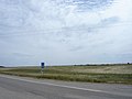
Echo Valley Scenic Route Hwy 10

Scenic Route
Adopt a Highway along Hwy 10.


Major intersections[]
From west to east:[6]
| Rural municipality | Location | km[1] | mi | Destinations | Notes | |||
|---|---|---|---|---|---|---|---|---|
| Edenwold No. 158 | Balgonie | 0.0 | 0.0 | Interchange; eastbound exit and westbound entrance | ||||
| South Qu'Appelle No. 157 | Edgeley | 24.5 | 15.2 | |||||
| North Qu'Appelle No. 187 | | 33.6 | 20.9 | |||||
| | 35.6 | 22.1 | West end of Hwy 35 concurrency | |||||
| Fort Qu'Appelle | 46.0 | 28.6 | East end of Hwy 35 concurrency; Hwy 56 passes underneath Hwy 10 east of intersection | |||||
| Abernethy No. 186 | Balcarres | 63.8 | 39.6 | |||||
| | 71.9 | 44.7 | ||||||
| | 88.2 | 54.8 | West of Duff | |||||
| Stanley No. 215 | | 109.1 | 67.8 | |||||
| City of Melville | 117.1 | 72.8 | West end of Hwy 47 concurrency | |||||
| 118.0 | 73.3 | |||||||
| 119.8 | 74.4 | East end of Hwy 47 concurrency | ||||||
| Cana No. 214 Orkney No. 244 |
No major junctions | |||||||
| City of Yorkton | 155.8 | 96.8 | Hwy 10 branches east | |||||
| 159.7 | 99.2 | Hwy 10 branches north; west end of Hwy 9 / Hwy 16 concurrence | ||||||
| 161.4 | 100.3 | Hwy 10 branches east; east end of Hwy 9 / Hwy 16 concurrence | ||||||
| Wallace No. 243 | Tonkin | 174.3 | 108.3 | West end of Hwy 637 concurrency | ||||
| | 179.2 | 111.3 | East end of Hwy 637 concurrency | |||||
| Calder No. 241 | Wroxton | 200.3 | 124.5 | West end of Hwy 8 concurrency | ||||
| | 210.1 | 130.6 | Calder access road | |||||
| | 220.0 | 136.7 | East end of Hwy 8 concurrency | |||||
| | 221.9 | 137.9 | ||||||
| | 225.1 | 139.9 | Continues into Manitoba | |||||
1.000 mi = 1.609 km; 1.000 km = 0.621 mi
| ||||||||
Highway 10A[]
Highway 10A | |
|---|---|
| Location | Yorkton |
| Length | 5.0 km[1] (3.1 mi) |
Highway 10A is a highway in the Canadian province of Saskatchewan serving the city of Yorkton. It runs from Highway 10 at the city's southwestern limits to Highway 16 / Highway 9 / Highway 10. Like most alternate routes, it was the original configuration for Highway 10 through Yorkton.
The highway travels northeast for approximately 2 km (1 mi) from Highway 10 (Queen Street) to Highway 52, where it travels east along Broadway Street. At Gladstone Avenue, Highway 16A joins Broadway Street, and the two highways run concurrently to its eastern terminus as Highway 16 / Highway 9 / Highway 10. Highway 10 continues east along Broadway Street.
Highway 10A is about 5 km (3 mi) long.[1]
Major intersections[]
From west to east. The entire route is in Yorkton.
| km[1] | mi | Destinations | Notes | ||
|---|---|---|---|---|---|
| 0.0 | 0.0 | Hwy 10A western terminus | |||
| 1.9 | 1.2 | Hwy 10A follows Broadway Street | |||
| 3.2 | 2.0 | West end of Hwy 16A concurrency | |||
| 5.0 | 3.1 | Hwy 10A / Hwy 16A eastern terminus | |||
1.000 mi = 1.609 km; 1.000 km = 0.621 mi
| |||||
References[]
- ^ a b c d e f Google (February 14, 2018). "Highway 10 in Saskatchewan" (Map). Google Maps. Google. Retrieved February 14, 2018.
- ^ "TYPE ADMN_CLASS TOLL_RD RTE_NUM1 RTE_NUM2 ROUTE 1 Gravel ..." Government of Canada. Retrieved 2008-02-17.
- ^ "Canada's National Highway System - Annual Report 2015" (PDF). Council of Ministers Responsible for Transportation and Highway Safety. September 2016. p. 31. Retrieved January 12, 2017.
- ^ Province of Saskatchewan (1926). Highway Map (Map). Department of Highways. Archived from the original on August 29, 2017.
- ^ Department of Highways and Transportation (1972). Saskatchewan Official Highway Map (Map). Government of Saskatchewan.
- ^ MapArt (2007). Saskatchewan Road Atlas (Map) (2007 ed.). 1:540,000. Oshawa, ON: Peter Heiler Ltd. pp. 35–36, 42–43. ISBN 1-55368-020-0.
External links[]
| Wikimedia Commons has media related to Saskatchewan Highway 10. |
Route map:

| ( • help)
|
- Saskatchewan provincial highways
- Transport in Yorkton