Saskatchewan Highway 210
 | ||||
|---|---|---|---|---|
| Route information | ||||
| Maintained by Ministry of Highways and Infrastructure | ||||
| Length | 20.9 km[1] (13.0 mi) | |||
| Major junctions | ||||
| South end | ||||
| North end | ||||
| Location | ||||
| Rural municipalities | North Qu'Appelle No. 187 | |||
| Highway system | ||||
| ||||
| ||||
Highway 210 is a provincial highway in the Canadian province of Saskatchewan. It runs from Highway 10 to Highway 35 in Fort Qu'Appelle. Highway 210 is about 21 km (13 mi) long.[1]
Highway 210 intersects Highway 56 and also passes through the Echo Valley Provincial Park, B-Say-Tah, and provides access to Pasqua and Echo Lakes of the Fishing Lakes.
Major intersections[]
From south to north:[2]
| Rural municipality | Location | km[1] | mi | Destinations | Notes |
|---|---|---|---|---|---|
| North Qu'Appelle No. 187 | | 0.0 | 0.0 | Southern terminus; Hwy 210 travels north | |
| Echo Valley Provincial Park | 12.1 | 7.5 | Hwy 210 branches east | ||
| Fort Qu'Appelle | 20.9 | 13.0 | Hwy 210 northern terminus | ||
| 190 m (620 ft) to the south | |||||
| 700 m (0.4 mi) to the north | |||||
| 1.000 mi = 1.609 km; 1.000 km = 0.621 mi | |||||
Photo gallery[]

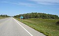
Highway 210 in Echo Valley Provincial Park
Highway 210 north to Fort San from Regina

Hwy 10 / Highway 210 junction (looking north-east)
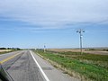
Pasqua First Nation #79 along Highway 210


See also[]
- Roads in Saskatchewan
References[]
- ^ a b c Google (7 February 2018). "Highway 210 in Saskatchewan" (Map). Google Maps. Google. Retrieved 7 February 2018.
- ^ MapArt (2007). Saskatchewan Road Atlas (Map) (2007 ed.). 1:540,000. Oshawa, ON: Peter Heiler Ltd. p. 42. ISBN 1-55368-020-0.
This Saskatchewan road, road transport or highway-related article is a stub. You can help Wikipedia by . |
Categories:
- Saskatchewan provincial highways
- Saskatchewan road stubs