Save (Garonne)
| Save | |
|---|---|
 | |
 | |
| Location | |
| Country | France |
| Physical characteristics | |
| Source | |
| • location | Plateau de Lannemezan |
| Mouth | |
• location | Garonne |
• coordinates | 43°47′32″N 1°16′41″E / 43.79222°N 1.27806°ECoordinates: 43°47′32″N 1°16′41″E / 43.79222°N 1.27806°E |
| Length | 143.8 km (89.4 mi) |
| Basin size | 1,152 km2 (445 sq mi) |
| Basin features | |
| Progression | Garonne→ Gironde estuary→ Atlantic Ocean |


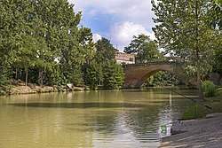
The Save (French pronunciation: [sav]; Occitan: Sava) is a 144 km long river in southern France, left tributary of the Garonne.[1] Its source is in the northern foothills of the Pyrenees, south of Lannemezan. It flows north-east through the following départements and cities:
It flows into the Garonne in Grenade, north of Toulouse.
Among its tributaries is the Gesse.
References[]
This Occitania geographical article is a stub. You can help Wikipedia by . |
Categories:
- Tributaries of the Garonne
- Rivers of France
- Rivers of Gers
- Rivers of Haute-Garonne
- Rivers of Hautes-Pyrénées
- Rivers of Occitania (administrative region)
- Occitania (administrative region) geography stubs
- France river stubs