Grenade, Haute-Garonne
Grenade | |
|---|---|
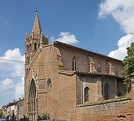 The church in Grenade | |
 Coat of arms | |
show Location of Grenade | |
 Grenade | |
| Coordinates: 43°46′20″N 1°17′37″E / 43.7722°N 1.2936°ECoordinates: 43°46′20″N 1°17′37″E / 43.7722°N 1.2936°E | |
| Country | France |
| Region | Occitanie |
| Department | Haute-Garonne |
| Arrondissement | Toulouse |
| Canton | Léguevin |
| Government | |
| • Mayor (2020–2026) | Jean-Paul Delmas |
| Area 1 | 37.01 km2 (14.29 sq mi) |
| Population (Jan. 2018)[1] | 8,841 |
| • Density | 240/km2 (620/sq mi) |
| Time zone | UTC+01:00 (CET) |
| • Summer (DST) | UTC+02:00 (CEST) |
| INSEE/Postal code | 31232 /31330 |
| Elevation | 97–167 m (318–548 ft) (avg. 115 m or 377 ft) |
| 1 French Land Register data, which excludes lakes, ponds, glaciers > 1 km2 (0.386 sq mi or 247 acres) and river estuaries. | |


Grenade (French pronunciation: [ɡʁənad] (![]() listen); Languedocien: Granada), also referred to as Grenade-sur-Garonne, is a commune in the Haute-Garonne department in southwestern France.
listen); Languedocien: Granada), also referred to as Grenade-sur-Garonne, is a commune in the Haute-Garonne department in southwestern France.
Population[]
|
|
Monuments[]
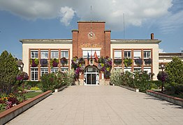
Town hall
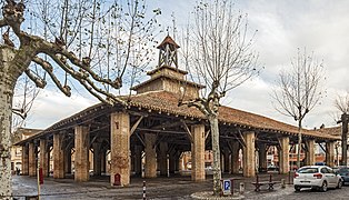
Market hall

War memorial

Church portal

Church interior

Convent


See also[]
References[]
- ^ "Populations légales 2018". INSEE. 28 December 2020.
| Wikimedia Commons has media related to Grenade (Haute-Garonne). |
| show Authority control |
|---|
This Haute-Garonne geographical article is a stub. You can help Wikipedia by . |
Categories:
- Communes of Haute-Garonne
- Haute-Garonne geography stubs