Galié
Galié | |
|---|---|
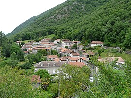 A general view of Galié | |
show Location of Galié | |
 Galié | |
| Coordinates: 42°59′22″N 0°38′01″E / 42.9894°N 0.6336°ECoordinates: 42°59′22″N 0°38′01″E�� / 42.9894°N 0.6336°E | |
| Country | France |
| Region | Occitanie |
| Department | Haute-Garonne |
| Arrondissement | Saint-Gaudens |
| Canton | Bagnères-de-Luchon |
| Government | |
| • Mayor (2020–2026) | Pierre Abbes[1] |
| Area 1 | 2.86 km2 (1.10 sq mi) |
| Population (Jan. 2018)[2] | 79 |
| • Density | 28/km2 (72/sq mi) |
| Time zone | UTC+01:00 (CET) |
| • Summer (DST) | UTC+02:00 (CEST) |
| INSEE/Postal code | 31207 /31510 |
| Elevation | 443–946 m (1,453–3,104 ft) (avg. 460 m or 1,510 ft) |
| 1 French Land Register data, which excludes lakes, ponds, glaciers > 1 km2 (0.386 sq mi or 247 acres) and river estuaries. | |


Galié is a commune in the Haute-Garonne department in southwestern France.
Population[]
| Year | Pop. | ±% |
|---|---|---|
| 1962 | 95 | — |
| 1968 | 73 | −23.2% |
| 1975 | 77 | +5.5% |
| 1982 | 86 | +11.7% |
| 1990 | 66 | −23.3% |
| 1999 | 78 | +18.2% |
| 2008 | 86 | +10.3% |
Sights[]
The Château de Galié is a ruined 13th and 14th century castle which has been listed since 1970 as a historic site by the French Ministry of Culture.[3]
See also[]
References[]
- ^ "Répertoire national des élus: les maires". data.gouv.fr, Plateforme ouverte des données publiques françaises (in French). 2 December 2020.
- ^ "Populations légales 2018". INSEE. 28 December 2020.
- ^ Base Mérimée: Château-fort, Ministère français de la Culture. (in French)
| Wikimedia Commons has media related to Galié. |
This Haute-Garonne geographical article is a stub. You can help Wikipedia by . |
Categories:
- Communes of Haute-Garonne
- Haute-Garonne geography stubs