Labarthe-Rivière
show This article may be expanded with text translated from the corresponding article in French. (June 2012) Click [show] for important translation instructions. |
Labarthe-Rivière | |
|---|---|
 The town hall in Labarthe-Rivière | |
 Coat of arms | |
show Location of Labarthe-Rivière | |
 Labarthe-Rivière | |
| Coordinates: 43°04′52″N 0°40′22″E / 43.0811°N 0.6728°ECoordinates: 43°04′52″N 0°40′22″E / 43.0811°N 0.6728°E | |
| Country | France |
| Region | Occitanie |
| Department | Haute-Garonne |
| Arrondissement | Saint-Gaudens |
| Canton | Saint-Gaudens |
| Government | |
| • Mayor (2020–2026) | Claire Vougny |
| Area 1 | 13.65 km2 (5.27 sq mi) |
| Population (Jan. 2018)[1] | 1,317 |
| • Density | 96/km2 (250/sq mi) |
| Time zone | UTC+01:00 (CET) |
| • Summer (DST) | UTC+02:00 (CEST) |
| INSEE/Postal code | 31247 /31800 |
| Elevation | 373–710 m (1,224–2,329 ft) (avg. 394 m or 1,293 ft) |
| 1 French Land Register data, which excludes lakes, ponds, glaciers > 1 km2 (0.386 sq mi or 247 acres) and river estuaries. | |


Labarthe-Rivière (French pronunciation: [labaʁt ʁivjɛʁ]; Occitan: Era Barta d'Arribèra) is a commune in the Haute-Garonne department in southwestern France.
Population[]
| Year | Pop. | ±% |
|---|---|---|
| 1962 | 896 | — |
| 1968 | 1,000 | +11.6% |
| 1975 | 1,177 | +17.7% |
| 1982 | 1,195 | +1.5% |
| 1990 | 1,198 | +0.3% |
| 1999 | 1,152 | −3.8% |
| 2008 | 1,324 | +14.9% |
Gallery[]
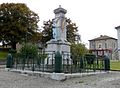
Monument to the dead

Sports fields


Rail tracks

Commune exit


See also[]
Communes of the Haute-Garonne department
References[]
- ^ "Populations légales 2018". INSEE. 28 December 2020.
| Wikimedia Commons has media related to Labarthe-Rivière. |
This Haute-Garonne geographical article is a stub. You can help Wikipedia by . |
Categories:
- Communes of Haute-Garonne
- Haute-Garonne geography stubs