Saiguède
Saiguède | |
|---|---|
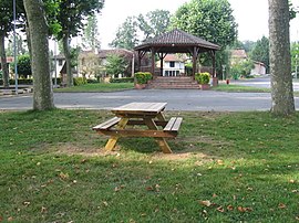 The bandstand in Saiguède | |
show Location of Saiguède | |
 Saiguède | |
| Coordinates: 43°31′48″N 1°08′41″E / 43.53°N 1.1447°ECoordinates: 43°31′48″N 1°08′41″E / 43.53°N 1.1447°E | |
| Country | France |
| Region | Occitanie |
| Department | Haute-Garonne |
| Arrondissement | Muret |
| Canton | Plaisance-du-Touch |
| Intercommunality | Le Muretain Agglo |
| Government | |
| • Mayor (2020–2026) | Catherine Cambefort[1] |
| Area 1 | 11.86 km2 (4.58 sq mi) |
| Population (Jan. 2018)[2] | 803 |
| • Density | 68/km2 (180/sq mi) |
| Time zone | UTC+01:00 (CET) |
| • Summer (DST) | UTC+02:00 (CEST) |
| INSEE/Postal code | 31466 /31470 |
| Elevation | 208–312 m (682–1,024 ft) (avg. 225 m or 738 ft) |
| 1 French Land Register data, which excludes lakes, ponds, glaciers > 1 km2 (0.386 sq mi or 247 acres) and river estuaries. | |


Saiguède (French pronunciation: [sɛɡɛd]; Occitan: Següeda) is a commune in the Haute-Garonne department in southwestern France, near the small town of Saint-Lys, and approximately 30 km west of Toulouse.
Features[]
Saiguède has a central public area, featuring a small school, teaching ages up to 11 years,[3] a pétanque square, and a small sports court. There is also a pavilion (kiosque).
Population[]
| Year | Pop. | ±% |
|---|---|---|
| 1962 | 178 | — |
| 1968 | 193 | +8.4% |
| 1975 | 204 | +5.7% |
| 1982 | 361 | +77.0% |
| 1990 | 445 | +23.3% |
| 1999 | 524 | +17.8% |
| 2006 | 768 | +46.6% |
| 2008 | 689 | −10.3% |
| 2011 | 768 | +11.5% |
| 2015 | 788 | +2.6% |
| 2016 | 784 | −0.5% |
| 2018 | 803 | +2.4% |
The inhabitants of Saiguède are known as Saiguediens.
See also[]
References[]
- ^ "Répertoire national des élus: les maires". data.gouv.fr, Plateforme ouverte des données publiques françaises (in French). 2 December 2020.
- ^ "Populations légales 2018". INSEE. 28 December 2020.
- ^ "Mairie de Saiguède".
| Wikimedia Commons has media related to Saiguède. |
This Haute-Garonne geographical article is a stub. You can help Wikipedia by . |
Categories:
- Communes of Haute-Garonne
- Haute-Garonne geography stubs