Forgues
Forgues | |
|---|---|
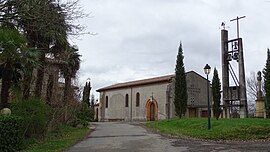 The church in Forgues | |
show Location of Forgues | |
 Forgues | |
| Coordinates: 43°25′58″N 1°02′47″E / 43.4328°N 1.0464°ECoordinates: 43°25′58″N 1°02′47″E / 43.4328°N 1.0464°E | |
| Country | France |
| Region | Occitanie |
| Department | Haute-Garonne |
| Arrondissement | Muret |
| Canton | Cazères |
| Government | |
| • Mayor (2020–2026) | William Larrieu |
| Area 1 | 5.24 km2 (2.02 sq mi) |
| Population (Jan. 2018)[1] | 215 |
| • Density | 41/km2 (110/sq mi) |
| Time zone | UTC+01:00 (CET) |
| • Summer (DST) | UTC+02:00 (CEST) |
| INSEE/Postal code | 31189 /31370 |
| Elevation | 203–328 m (666–1,076 ft) (avg. 290 m or 950 ft) |
| 1 French Land Register data, which excludes lakes, ponds, glaciers > 1 km2 (0.386 sq mi or 247 acres) and river estuaries. | |


Forgues (French pronunciation: [fɔʁɡ]; Occitan: Hòrgas) is a commune in the Haute-Garonne department in southwestern France.
Population[]
| Year | Pop. | ±% |
|---|---|---|
| 1962 | 58 | — |
| 1968 | 90 | +55.2% |
| 1975 | 72 | −20.0% |
| 1982 | 75 | +4.2% |
| 1990 | 120 | +60.0% |
| 1999 | 152 | +26.7% |
| 2008 | 182 | +19.7% |
See also[]
References[]
- ^ "Populations légales 2018". INSEE. 28 December 2020.
| Wikimedia Commons has media related to Forgues (Haute-Garonne). |
This Haute-Garonne geographical article is a stub. You can help Wikipedia by . |
Categories:
- Communes of Haute-Garonne
- Haute-Garonne geography stubs