Cépet
Cépet | |
|---|---|
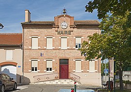 Town hall | |
 Coat of arms | |
show Location of Cépet | |
 Cépet | |
| Coordinates: 43°45′02″N 1°25′55″E / 43.7506°N 1.4319°ECoordinates: 43°45′02″N 1°25′55″E / 43.7506°N 1.4319°E | |
| Country | France |
| Region | Occitanie |
| Department | Haute-Garonne |
| Arrondissement | Toulouse |
| Canton | Villemur-sur-Tarn |
| Government | |
| • Mayor (2008–2014) | Michel Laynat |
| Area 1 | 7.11 km2 (2.75 sq mi) |
| Population (Jan. 2018)[1] | 2,003 |
| • Density | 280/km2 (730/sq mi) |
| Time zone | UTC+01:00 (CET) |
| • Summer (DST) | UTC+02:00 (CEST) |
| INSEE/Postal code | 31136 /31620 |
| Elevation | 123–185 m (404–607 ft) (avg. 118 m or 387 ft) |
| 1 French Land Register data, which excludes lakes, ponds, glaciers > 1 km2 (0.386 sq mi or 247 acres) and river estuaries. | |


Cépet is a commune in the Haute-Garonne department in southwestern France.
Population[]
| Year | Pop. | ±% |
|---|---|---|
| 1962 | 344 | — |
| 1968 | 481 | +39.8% |
| 1975 | 697 | +44.9% |
| 1982 | 908 | +30.3% |
| 1990 | 1,023 | +12.7% |
| 1999 | 1,315 | +28.5% |
| 2006 | 1,455 | +10.6% |
| 2007 | 1,477 | +1.5% |
| 2008 | 1,499 | +1.5% |
| 2018 | 2,003 | +33.6% |
See also[]
References[]
- ^ "Populations légales 2018". INSEE. 28 December 2020.
| Wikimedia Commons has media related to Cépet (Haute-Garonne). |
| Authority control |
|
|---|
This Haute-Garonne geographical article is a stub. You can help Wikipedia by . |
Categories:
- Communes of Haute-Garonne
- Haute-Garonne geography stubs