Labruyère-Dorsa
Labruyère-Dorsa | |
|---|---|
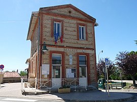 The town hall in Labruyère-Dorsa | |
show Location of Labruyère-Dorsa | |
 Labruyère-Dorsa | |
| Coordinates: 43°24′29″N 1°28′14″E / 43.4081°N 1.4706°ECoordinates: 43°24′29″N 1°28′14″E / 43.4081°N 1.4706°E | |
| Country | France |
| Region | Occitanie |
| Department | Haute-Garonne |
| Arrondissement | Muret |
| Canton | Auterive |
| Government | |
| • Mayor (2020–2026) | Julien Godefroy |
| Area 1 | 2.19 km2 (0.85 sq mi) |
| Population (Jan. 2018)[1] | 290 |
| • Density | 130/km2 (340/sq mi) |
| Time zone | UTC+01:00 (CET) |
| • Summer (DST) | UTC+02:00 (CEST) |
| INSEE/Postal code | 31256 /31190 |
| Elevation | 184–252 m (604–827 ft) (avg. 240 m or 790 ft) |
| 1 French Land Register data, which excludes lakes, ponds, glaciers > 1 km2 (0.386 sq mi or 247 acres) and river estuaries. | |


Labruyère-Dorsa (French pronunciation: [labʁɥijɛʁ dɔʁsa]; Occitan: La Bruguièra Dorçan) is a commune in the Haute-Garonne department in southwestern France.
Population[]
| Year | Pop. | ±% |
|---|---|---|
| 1962 | 31 | — |
| 1968 | 59 | +90.3% |
| 1975 | 59 | +0.0% |
| 1982 | 55 | −6.8% |
| 1990 | 88 | +60.0% |
| 1999 | 143 | +62.5% |
| 2008 | 237 | +65.7% |
See also[]
Communes of the Haute-Garonne department
References[]
- ^ "Populations légales 2018". INSEE. 28 December 2020.
| Wikimedia Commons has media related to Labruyère-Dorsa. |
This Haute-Garonne geographical article is a stub. You can help Wikipedia by . |
Categories:
- Communes of Haute-Garonne
- Haute-Garonne geography stubs