Poucharramet
Poucharramet | |
|---|---|
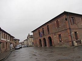 The town hall in Poucharramet | |
 Coat of arms | |
show Location of Poucharramet | |
 Poucharramet | |
| Coordinates: 43°25′05″N 1°10′29″E / 43.4181°N 1.1747°ECoordinates: 43°25′05″N 1°10′29″E / 43.4181°N 1.1747°E | |
| Country | France |
| Region | Occitanie |
| Department | Haute-Garonne |
| Arrondissement | Muret |
| Canton | Cazères |
| Government | |
| • Mayor (2008–2014) | Jean-Jacques Le Gal |
| Area 1 | 22.53 km2 (8.70 sq mi) |
| Population (Jan. 2018)[1] | 909 |
| • Density | 40/km2 (100/sq mi) |
| Time zone | UTC+01:00 (CET) |
| • Summer (DST) | UTC+02:00 (CEST) |
| INSEE/Postal code | 31435 /31370 |
| Elevation | 196–260 m (643–853 ft) (avg. 235 m or 771 ft) |
| 1 French Land Register data, which excludes lakes, ponds, glaciers > 1 km2 (0.386 sq mi or 247 acres) and river estuaries. | |


Poucharramet is a commune in the Haute-Garonne department in southwestern France.
Population[]
| Year | Pop. | ±% |
|---|---|---|
| 1962 | 484 | — |
| 1968 | 504 | +4.1% |
| 1975 | 560 | +11.1% |
| 1982 | 621 | +10.9% |
| 1990 | 649 | +4.5% |
| 1999 | 680 | +4.8% |
| 2008 | 829 | +21.9% |
See also[]
References[]
- ^ "Populations légales 2018". INSEE. 28 December 2020.
| Wikimedia Commons has media related to Poucharramet. |
This Haute-Garonne geographical article is a stub. You can help Wikipedia by . |
Categories:
- Communes of Haute-Garonne
- Haute-Garonne geography stubs