Landorthe
Landorthe | |
|---|---|
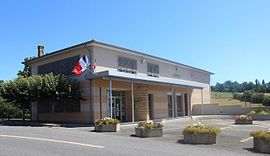 The town hall in Landorthe | |
show Location of Landorthe | |
 Landorthe | |
| Coordinates: 43°07′57″N 0°47′05″E / 43.1325°N 0.7847°ECoordinates: 43°07′57″N 0°47′05″E / 43.1325°N 0.7847°E | |
| Country | France |
| Region | Occitanie |
| Department | Haute-Garonne |
| Arrondissement | Saint-Gaudens |
| Canton | Saint-Gaudens |
| Government | |
| • Mayor (2008–2014) | Jeanine Brunet |
| Area 1 | 9.65 km2 (3.73 sq mi) |
| Population (Jan. 2018)[1] | 1,000 |
| • Density | 100/km2 (270/sq mi) |
| Time zone | UTC+01:00 (CET) |
| • Summer (DST) | UTC+02:00 (CEST) |
| INSEE/Postal code | 31270 /31800 |
| Elevation | 343–463 m (1,125–1,519 ft) (avg. 380 m or 1,250 ft) |
| 1 French Land Register data, which excludes lakes, ponds, glaciers > 1 km2 (0.386 sq mi or 247 acres) and river estuaries. | |


Landorthe is a commune in the Haute-Garonne department in southwestern France.
Population[]
| Year | Pop. | ±% |
|---|---|---|
| 1962 | 172 | — |
| 1968 | 181 | +5.2% |
| 1975 | 389 | +114.9% |
| 1982 | 611 | +57.1% |
| 1990 | 757 | +23.9% |
| 1999 | 779 | +2.9% |
| 2008 | 937 | +20.3% |
See also[]
References[]
- ^ "Populations légales 2018". INSEE. 28 December 2020.
| Wikimedia Commons has media related to Landorthe. |
This Haute-Garonne geographical article is a stub. You can help Wikipedia by . |
Categories:
- Communes of Haute-Garonne
- Haute-Garonne geography stubs