Bagiry
Bagiry | |
|---|---|
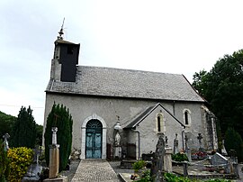 The church in Bagiry | |
show Location of Bagiry | |
 Bagiry | |
| Coordinates: 42°58′43″N 0°37′36″E / 42.9786°N 0.6267°ECoordinates: 42°58′43″N 0°37′36″E / 42.9786°N 0.6267°E | |
| Country | France |
| Region | Occitanie |
| Department | Haute-Garonne |
| Arrondissement | Saint-Gaudens |
| Canton | Bagnères-de-Luchon |
| Government | |
| • Mayor (2020–2026) | Joseph Moretto |
| Area 1 | 2.78 km2 (1.07 sq mi) |
| Population (Jan. 2018)[1] | 112 |
| • Density | 40/km2 (100/sq mi) |
| Time zone | UTC+01:00 (CET) |
| • Summer (DST) | UTC+02:00 (CEST) |
| INSEE/Postal code | 31041 /31510 |
| Elevation | 449–1,002 m (1,473–3,287 ft) (avg. 457 m or 1,499 ft) |
| 1 French Land Register data, which excludes lakes, ponds, glaciers > 1 km2 (0.386 sq mi or 247 acres) and river estuaries. | |


Bagiry (French pronunciation: [baʒiʁi]; Occitan: Bagiri) is a commune in the Haute-Garonne department in southwestern France.
Population[]
| Year | Pop. | ±% |
|---|---|---|
| 1962 | 123 | — |
| 1968 | 110 | −10.6% |
| 1975 | 111 | +0.9% |
| 1982 | 114 | +2.7% |
| 1990 | 88 | −22.8% |
| 1999 | 77 | −12.5% |
| 2008 | 80 | +3.9% |
See also[]
References[]
- ^ "Populations légales 2018". INSEE. 28 December 2020.
| Wikimedia Commons has media related to Bagiry. |
This Haute-Garonne geographical article is a stub. You can help Wikipedia by . |
Categories:
- Communes of Haute-Garonne
- Haute-Garonne geography stubs