Lagarde, Haute-Garonne
Lagarde Lauragais | |
|---|---|
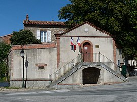 The town hall in Lagarde | |
 Coat of arms | |
show Location of Lagarde Lauragais | |
 Lagarde Lauragais | |
| Coordinates: 43°20′47″N 1°42′50″E / 43.3464°N 1.7139°ECoordinates: 43°20′47″N 1°42′50″E / 43.3464°N 1.7139°E | |
| Country | France |
| Region | Occitanie |
| Department | Haute-Garonne |
| Arrondissement | Toulouse |
| Canton | Revel |
| Government | |
| • Mayor (2008–2014) | Éric Marty |
| Area 1 | 11.69 km2 (4.51 sq mi) |
| Population (Jan. 2018)[1] | 415 |
| • Density | 36/km2 (92/sq mi) |
| Time zone | UTC+01:00 (CET) |
| • Summer (DST) | UTC+02:00 (CEST) |
| INSEE/Postal code | 31262 /31290 |
| Elevation | 185–292 m (607–958 ft) (avg. 280 m or 920 ft) |
| 1 French Land Register data, which excludes lakes, ponds, glaciers > 1 km2 (0.386 sq mi or 247 acres) and river estuaries. | |


Lagarde is a commune in the Haute-Garonne department in southwestern France.
Population[]
| Year | Pop. | ±% |
|---|---|---|
| 1962 | 230 | — |
| 1968 | 243 | +5.7% |
| 1975 | 195 | −19.8% |
| 1982 | 176 | −9.7% |
| 1990 | 194 | +10.2% |
| 1999 | 239 | +23.2% |
| 2008 | 296 | +23.8% |
See also[]
Communes of the Haute-Garonne department
References[]
- ^ "Populations légales 2018". INSEE. 28 December 2020.
| Wikimedia Commons has media related to Lagarde (Haute-Garonne). |
This Haute-Garonne geographical article is a stub. You can help Wikipedia by . |
Categories:
- Communes of Haute-Garonne
- Haute-Garonne geography stubs