Vallègue
Vallègue | |
|---|---|
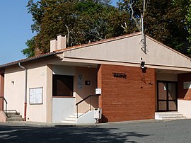 The town hall in Vallègue | |
 Coat of arms | |
Location of Vallègue  | |
 Vallègue | |
| Coordinates: 43°25′31″N 1°45′18″E / 43.4253°N 1.755°ECoordinates: 43°25′31″N 1°45′18″E / 43.4253°N 1.755°E | |
| Country | France |
| Region | Occitanie |
| Department | Haute-Garonne |
| Arrondissement | Toulouse |
| Canton | Revel |
| Government | |
| • Mayor (2020–2026) | Rémy Zanatta |
| Area 1 | 4.18 km2 (1.61 sq mi) |
| Population (Jan. 2018)[1] | 522 |
| • Density | 120/km2 (320/sq mi) |
| Time zone | UTC+01:00 (CET) |
| • Summer (DST) | UTC+02:00 (CEST) |
| INSEE/Postal code | 31566 /31290 |
| Elevation | 197–261 m (646–856 ft) (avg. 243 m or 797 ft) |
| 1 French Land Register data, which excludes lakes, ponds, glaciers > 1 km2 (0.386 sq mi or 247 acres) and river estuaries. | |


Vallègue (French pronunciation: [valɛɡ]; Occitan: Valèga) is a commune in the Haute-Garonne department in southwestern France.
Population[]
| Year | Pop. | ±% |
|---|---|---|
| 1962 | 158 | — |
| 1968 | 164 | +3.8% |
| 1975 | 192 | +17.1% |
| 1982 | 244 | +27.1% |
| 1990 | 267 | +9.4% |
| 1999 | 383 | +43.4% |
| 2008 | 485 | +26.6% |
Sights[]
The Château de Vallègue is a mediaeval castle which is listed as a historic site by the French Ministry of Culture.[2]
See also[]
References[]
- ^ "Populations légales 2018". The National Institute of Statistics and Economic Studies. 28 December 2020.
- ^ Base Mérimée: Château, Ministère français de la Culture. (in French)
| Wikimedia Commons has media related to Vallègue. |
| Prefecture |
|
|---|---|
| Subprefectures |
|
| Other |
|
This Haute-Garonne geographical article is a stub. You can help Wikipedia by . |
Categories:
- Communes of Haute-Garonne
- Haute-Garonne geography stubs