Saint-Martory
Saint-Martory | |
|---|---|
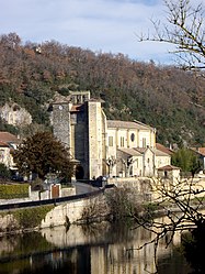 The church in Saint-Martory | |
 Coat of arms | |
show Location of Saint-Martory | |
 Saint-Martory | |
| Coordinates: 43°08′37″N 0°55′48″E / 43.1436°N 0.93°ECoordinates: 43°08′37″N 0°55′48″E / 43.1436°N 0.93°E | |
| Country | France |
| Region | Occitanie |
| Department | Haute-Garonne |
| Arrondissement | Saint-Gaudens |
| Canton | Bagnères-de-Luchon |
| Government | |
| • Mayor (2008–2014) | Joseph Lafuste |
| Area 1 | 8.3 km2 (3.2 sq mi) |
| Population (Jan. 2018)[1] | 1,000 |
| • Density | 120/km2 (310/sq mi) |
| Time zone | UTC+01:00 (CET) |
| • Summer (DST) | UTC+02:00 (CEST) |
| INSEE/Postal code | 31503 /31360 |
| Elevation | 269–485 m (883–1,591 ft) (avg. 287 m or 942 ft) |
| 1 French Land Register data, which excludes lakes, ponds, glaciers > 1 km2 (0.386 sq mi or 247 acres) and river estuaries. | |


Saint-Martory is a commune in the Haute-Garonne department in southwestern France.
Population[]
| Year | Pop. | ±% |
|---|---|---|
| 1962 | 1,066 | — |
| 1968 | 1,101 | +3.3% |
| 1975 | 1,133 | +2.9% |
| 1982 | 1,166 | +2.9% |
| 1990 | 940 | −19.4% |
| 1999 | 873 | −7.1% |
| 2008 | 854 | −2.2% |
| 2018 | 1,000 | +17.1% |
See also[]
References[]
- ^ "Populations légales 2018". INSEE. 28 December 2020.
| Wikimedia Commons has media related to Saint-Martory. |
This Haute-Garonne geographical article is a stub. You can help Wikipedia by . |
Categories:
- Communes of Haute-Garonne
- Haute-Garonne geography stubs