Seyre
Seyre | |
|---|---|
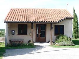 The town hall in Seyre | |
show Location of Seyre | |
 Seyre | |
| Coordinates: 43°21′51″N 1°40′12″E / 43.3642°N 1.67°ECoordinates: 43°21′51″N 1°40′12″E / 43.3642°N 1.67°E | |
| Country | France |
| Region | Occitanie |
| Department | Haute-Garonne |
| Arrondissement | Toulouse |
| Canton | Escalquens |
| Government | |
| • Mayor (2008–2014) | Josiane Rancinangue |
| Area 1 | 3.89 km2 (1.50 sq mi) |
| Population (Jan. 2018)[1] | 131 |
| • Density | 34/km2 (87/sq mi) |
| Time zone | UTC+01:00 (CET) |
| • Summer (DST) | UTC+02:00 (CEST) |
| INSEE/Postal code | 31546 /31560 |
| Elevation | 185–262 m (607–860 ft) (avg. 250 m or 820 ft) |
| 1 French Land Register data, which excludes lakes, ponds, glaciers > 1 km2 (0.386 sq mi or 247 acres) and river estuaries. | |


Seyre is a commune in the Haute-Garonne department in southwestern France.
Population[]
| Year | Pop. | ±% |
|---|---|---|
| 1962 | 70 | — |
| 1968 | 76 | +8.6% |
| 1975 | 77 | +1.3% |
| 1982 | 82 | +6.5% |
| 1990 | 79 | −3.7% |
| 1999 | 76 | −3.8% |
| 2008 | 98 | +28.9% |
See also[]
References[]
- ^ "Populations légales 2018". INSEE. 28 December 2020.
| Wikimedia Commons has media related to Seyre. |
This Haute-Garonne geographical article is a stub. You can help Wikipedia by . |
Categories:
- Communes of Haute-Garonne
- Haute-Garonne geography stubs