Franquevielle
Franquevielle | |
|---|---|
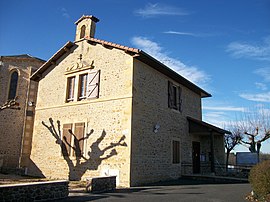 The town hall in Franquevielle | |
show Location of Franquevielle | |
 Franquevielle | |
| Coordinates: 43°08′15″N 0°32′02″E / 43.1375°N 0.5339°ECoordinates: 43°08′15″N 0°32′02″E / 43.1375°N 0.5339°E | |
| Country | France |
| Region | Occitanie |
| Department | Haute-Garonne |
| Arrondissement | Saint-Gaudens |
| Canton | Saint-Gaudens |
| Government | |
| • Mayor (2008–2014) | Pierrette Martin-Louge |
| Area 1 | 10.88 km2 (4.20 sq mi) |
| Population (Jan. 2018)[1] | 330 |
| • Density | 30/km2 (79/sq mi) |
| Time zone | UTC+01:00 (CET) |
| • Summer (DST) | UTC+02:00 (CEST) |
| INSEE/Postal code | 31197 /31210 |
| Elevation | 437–565 m (1,434–1,854 ft) (avg. 500 m or 1,600 ft) |
| 1 French Land Register data, which excludes lakes, ponds, glaciers > 1 km2 (0.386 sq mi or 247 acres) and river estuaries. | |


Franquevielle is a commune in the Haute-Garonne department in southwestern France.
Population[]
| Year | Pop. | ±% |
|---|---|---|
| 1962 | 373 | — |
| 1968 | 403 | +8.0% |
| 1975 | 362 | −10.2% |
| 1982 | 379 | +4.7% |
| 1990 | 349 | −7.9% |
| 1999 | 333 | −4.6% |
| 2008 | 353 | +6.0% |
See also[]
References[]
- ^ "Populations légales 2018". INSEE. 28 December 2020.
| Wikimedia Commons has media related to Franquevielle. |
This Haute-Garonne geographical article is a stub. You can help Wikipedia by . |
Categories:
- Communes of Haute-Garonne
- Haute-Garonne geography stubs