Sela pri Dobu
Sela pri Dobu | |
|---|---|
 | |
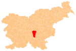
 Sela pri Dobu Location in Slovenia | |
| Coordinates: 45°55′38.97″N 14°52′6.97″E / 45.9274917°N 14.8686028°ECoordinates: 45°55′38.97″N 14°52′6.97″E / 45.9274917°N 14.8686028°E | |
| Country | |
| Traditional region | Lower Carniola |
| Statistical region | Central Slovenia |
| Municipality | Ivančna Gorica |
| Area | |
| • Total | 0.47 km2 (0.18 sq mi) |
| Elevation | 313.3 m (1,027.9 ft) |
| Population (2002) | |
| • Total | 25 |
| [1] | |

Sela pri Dobu (pronounced [ˈseːla pɾi ˈdoːbu]; German: Selo bei Dob[2]) is a small settlement just south of Dob pri Šentvidu in the Municipality of Ivančna Gorica in central Slovenia. The area is part of the historical region of Lower Carniola. The municipality is now included in the Central Slovenia Statistical Region.[3]
Name[]
The name of the settlement was changed from Sela to Sela pri Dobu in 1953.[4] In the past the German name was Selo bei Dob.[2]
Cultural heritage[]
During the construction of the A2 Slovenian motorway south of the settlement in 1996 an archaeological site with continuous Late Bronze Age to Roman period settlement layers was discovered. The site was excavated in 1998 and 1999.[5]
References[]
- ^ Statistical Office of the Republic of Slovenia
- ^ Jump up to: a b Leksikon občin kraljestev in dežel zastopanih v državnem zboru, vol. 6: Kranjsko. 1906. Vienna: C. Kr. Dvorna in Državna Tiskarna, p. 100.
- ^ Ivančna Gorica municipal site
- ^ Spremembe naselij 1948–95. 1996. Database. Ljubljana: Geografski inštitut ZRC SAZU, DZS.
- ^ "EŠD 15533". Registry of Immovable Cultural Heritage (in Slovenian). Ministry of Culture of the Republic of Slovenia. Retrieved 2 September 2011.
External links[]
 Media related to Sela pri Dobu at Wikimedia Commons
- Sela pri Dobu at Geopedia
This article about the Municipality of Ivančna Gorica in Slovenia is a stub. You can help Wikipedia by . |
- Populated places in the Municipality of Ivančna Gorica
- Ivančna Gorica geography stubs