Vrhpolje pri Šentvidu
Vrhpolje pri Šentvidu | |
|---|---|
 | |
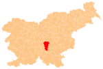
 Vrhpolje pri Šentvidu Location in Slovenia | |
| Coordinates: 45°56′10.47″N 14°49′8.62″E / 45.9362417°N 14.8190611°ECoordinates: 45°56′10.47″N 14°49′8.62″E / 45.9362417°N 14.8190611°E | |
| Country | |
| Traditional region | Lower Carniola |
| Statistical region | Central Slovenia |
| Municipality | Ivančna Gorica |
| Area | |
| • Total | 1.03 km2 (0.40 sq mi) |
| Elevation | 321.9 m (1,056.1 ft) |
| Population (2002) | |
| • Total | 77 |
| [1] | |

Vrhpolje pri Šentvidu (pronounced [ˈʋəɾxpɔljɛ pɾi ʃɛnˈtʋiːdu]; German: Oberfeld[2]) is a settlement east of Ivančna Gorica in the Lower Carniola region of Slovenia. The area is now included in the Central Slovenia Statistical Region.[3]
Name[]
The name of the settlement was changed from Vrhpolje to Vrhpolje pri Šentvidu in 1953.[4] In the past the German name was Oberfeld.[2]
References[]
- ^ Statistical Office of the Republic of Slovenia
- ^ Jump up to: a b Leksikon občin kraljestev in dežel zastopanih v državnem zboru, vol. 6: Kranjsko. Vienna: C. Kr. Dvorna in Državna Tiskarna. 1906. p. 102.
- ^ Ivančna Gorica municipal site
- ^ Spremembe naselij 1948–95. 1996. Database. Ljubljana: Geografski inštitut ZRC SAZU, DZS.
External links[]
 Media related to Vrhpolje pri Šentvidu at Wikimedia Commons
- Vrhpolje pri Šentvidu at Geopedia
This article about the Municipality of Ivančna Gorica in Slovenia is a stub. You can help Wikipedia by . |
Categories:
- Populated places in the Municipality of Ivančna Gorica
- Ivančna Gorica geography stubs