Spodnja Draga
Spodnja Draga | |
|---|---|
 | |
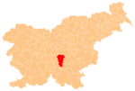
 Spodnja Draga Location in Slovenia | |
| Coordinates: 45°56′2.45″N 14°46′46.59″E / 45.9340139°N 14.7796083°ECoordinates: 45°56′2.45″N 14°46′46.59″E / 45.9340139°N 14.7796083°E | |
| Country | |
| Traditional region | Lower Carniola |
| Statistical region | Central Slovenia |
| Municipality | Ivančna Gorica |
| Area | |
| • Total | 1.79 km2 (0.69 sq mi) |
| Elevation | 338.5 m (1,110.6 ft) |
| Population (2002) | |
| • Total | 112 |
| [1] | |

Spodnja Draga (pronounced [ˈspoːdnja ˈdɾaːɡa]) is a village west of Ivančna Gorica in the historical region of Lower Carniola in Slovenia. The Municipality of Ivančna Gorica is included in the Central Slovenia Statistical Region.[2]
Name[]
The name Spodnja Draga literally means 'lower Draga', distinguishing the settlement from neighboring Zgornja Draga (literally, 'upper Draga'). The name is derived from the Slovene common noun draga 'small, narrow valley', referring to the geographical location of the settlement.[3]
Church[]

Saint Thomas's Church
The local church is dedicated to Saint Thomas and belongs to the Parish of Ivančna Gorica. It dates to the 14th century.[4]
References[]
- ^ Statistical Office of the Republic of Slovenia
- ^ Ivančna Gorica municipal site
- ^ Snoj, Marko (2009). Etimološki slovar slovenskih zemljepisnih imen. Ljubljana: Modrijan. p. 120.
- ^ "EŠD 2344". Registry of Immovable Cultural Heritage (in Slovenian). Ministry of Culture of the Republic of Slovenia. Retrieved 2 September 2011.
External links[]
 Media related to Spodnja Draga at Wikimedia Commons
- Spodnja Draga at Geopedia
This article about the Municipality of Ivančna Gorica in Slovenia is a stub. You can help Wikipedia by . |
Categories:
- Populated places in the Municipality of Ivančna Gorica
- Ivančna Gorica geography stubs