Senath, Missouri
Senath | |
|---|---|
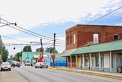 Commercial Street (State Highway P) | |
| Motto(s): Little City With A Big Heart | |
 Location of Senath, Missouri | |
| Coordinates: 36°8′0″N 90°9′36″W / 36.13333°N 90.16000°WCoordinates: 36°8′0″N 90°9′36″W / 36.13333°N 90.16000°W | |
| Country | United States |
| State | Missouri |
| County | Dunklin |
| Area | |
| • Total | 1.92 sq mi (4.98 km2) |
| • Land | 1.92 sq mi (4.98 km2) |
| • Water | 0.00 sq mi (0.00 km2) |
| Elevation | 256 ft (78 m) |
| Population | |
| • Total | 1,767 |
| • Estimate (2019)[4] | 1,611 |
| • Density | 837.32/sq mi (323.32/km2) |
| Time zone | UTC-6 (Central (CST)) |
| • Summer (DST) | UTC-5 (CDT) |
| ZIP code | 63876 |
| FIPS code | 29-66638 |
| GNIS feature ID | 0726200[3] |
Senath /ˈsiːnəθ/ (SEE-nəth) is a city in Dunklin County, Missouri, United States. The population was 1,767 at the 2010 census.
History[]
Senath was founded in 1882.[5] It is named after an early settler, Asenath Douglass, who was commonly called Senath and in whose family her Bible-derived name Asenath was pronounced with a long "e" and with stress on the second syllable.[6][7] A post office called Senath has been in operation since 1881.[8]
Geography[]
The city lies in the southwestern Bootheel approximately nine miles southwest of Kennett along U.S. Route 412. Senath is served by Missouri supplemental routes A, C and P.[9]
According to the United States Census Bureau, the city has a total area of 1.92 square miles (4.97 km2), all land.[10]
Demographics[]
| Historical population | |||
|---|---|---|---|
| Census | Pop. | %± | |
| 1900 | 241 | — | |
| 1910 | 1,029 | 327.0% | |
| 1920 | 1,054 | 2.4% | |
| 1930 | 1,086 | 3.0% | |
| 1940 | 1,261 | 16.1% | |
| 1950 | 1,528 | 21.2% | |
| 1960 | 1,369 | −10.4% | |
| 1970 | 1,484 | 8.4% | |
| 1980 | 1,728 | 16.4% | |
| 1990 | 1,622 | −6.1% | |
| 2000 | 1,650 | 1.7% | |
| 2010 | 1,767 | 7.1% | |
| 2019 (est.) | 1,611 | [4] | −8.8% |
| U.S. Decennial Census[11] | |||
2010 census[]
As of the census[2] of 2010, there were 1,767 people, 661 households, and 433 families living in the city. The population density was 920.3 inhabitants per square mile (355.3/km2). There were 765 housing units at an average density of 398.4 per square mile (153.8/km2). The racial makeup of the city was 76.74% White, 1.08% Black or African American, 0.17% Native American, 0.11% Asian, 20.71% from other races, and 1.19% from two or more races. Hispanic or Latino of any race were 27.62% of the population.
There were 661 households, of which 37.1% had children under the age of 18 living with them, 48.4% were married couples living together, 11.8% had a female householder with no husband present, 5.3% had a male householder with no wife present, and 34.5% were non-families. 31.0% of all households were made up of individuals, and 17.1% had someone living alone who was 65 years of age or older. The average household size was 2.56 and the average family size was 3.24.
The median age in the city was 37 years. 28.5% of residents were under the age of 18; 7.2% were between the ages of 18 and 24; 23.8% were from 25 to 44; 22.9% were from 45 to 64; and 17.5% were 65 years of age or older. The gender makeup of the city was 46.3% male and 53.7% female.
2000 census[]
As of the census[12] of 2000, there were 1,650 people, 688 households, and 427 families living in the city. The population density was 865.3 people per square mile (333.5/km2). There were 783 housing units at an average density of 410.6 per square mile (158.3/km2). The racial makeup of the city was 91.76% White, 0.55% African American, 0.36% Native American, 0.06% Asian, 6.48% from other races, and 0.79% from two or more races. Hispanic or Latino of any race were 11.58% of the population.
There were 688 households, of which 26.3% had children under the age of 18 living with them, 48.0% were married couples living together, 10.9% had a female householder with no husband present, and 37.8% were non-families. Of all households, 34.2% were made up of individuals, and 20.3% had someone living alone who was 65 years of age or older. The average household size was 2.26 and the average family size was 2.89.
Of the city's population, 22.5% were under the age of 18, 7.2% were from 18 to 24, 24.7% were from 25 to 44, 20.8% were from 45 to 64, and 24.8% were 65 years of age or older. The median age was 41 years. For every 100 females, there were 88.4 males. For every 100 females age 18 and over, there were 81.4 males.
Education[]
Senath-Hornersville C-8 School District operates one elementary school and Senath-Hornersville Sr. High School the middle school is located in Hornersville Mo in the city.[13]
Senath has a public library, a branch of the Dunklin County Library.[14]
Notable people[]
- Onie Wheeler (1921–1984) – bluegrass/country/rockabilly musician
References[]
- ^ "2019 U.S. Gazetteer Files". United States Census Bureau. Retrieved July 26, 2020.
- ^ Jump up to: a b "U.S. Census website". United States Census Bureau. Retrieved 2012-07-08.
- ^ Jump up to: a b U.S. Geological Survey Geographic Names Information System: Senath, Missouri
- ^ Jump up to: a b "Population and Housing Unit Estimates". United States Census Bureau. May 24, 2020. Retrieved May 27, 2020.
- ^ Eaton, David Wolfe (1916). How Missouri Counties, Towns and Streams Were Named. The State Historical Society of Missouri. pp. 166.
- ^ "Transcription of Mary F. Smyth-Davis, 'History of Dunklin County, Mo., 1845-1895,' St. Louis: Nixon-Jones Printing Co., 1896".
- ^ "Dunklin County Place Names, 1928–1945 (archived)". The State Historical Society of Missouri. Archived from the original on 24 June 2016. Retrieved 29 September 2016.CS1 maint: bot: original URL status unknown (link)
- ^ "Post Offices". Jim Forte Postal History. Retrieved 29 September 2016.
- ^ Missouri Atlas & Gazetteer, DeLorme, 1st ed., 1998, p. 70 ISBN 0899332242
- ^ "US Gazetteer files 2010". United States Census Bureau. Archived from the original on 2012-07-02. Retrieved 2012-07-08.
- ^ "Census of Population and Housing". Census.gov. Retrieved June 4, 2015.
- ^ "U.S. Census website". United States Census Bureau. Retrieved 2008-01-31.
- ^ "Senath-Hornersville C-8 School District". Great Schools. Retrieved 17 March 2018.
- ^ "Locations". Dunklin County Library. Retrieved 17 March 2018.
External links[]
 Media related to Senath, Missouri at Wikimedia Commons
| show Municipalities and communities of Dunklin County, Missouri, United States |
|---|

| show Authority control |
|---|
- Cities in Dunklin County, Missouri
- Cities in Missouri