Serrig
Serrig | |
|---|---|
 Coat of arms | |
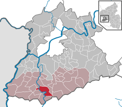
show Location of Serrig within Trier-Saarburg district | |
 Serrig | |
| Coordinates: 49°34′29″N 6°34′24″E / 49.57472°N 6.57333°ECoordinates: 49°34′29″N 6°34′24″E / 49.57472°N 6.57333°E | |
| Country | Germany |
| State | Rhineland-Palatinate |
| District | Trier-Saarburg |
| Municipal assoc. | Saarburg-Kell |
| Government | |
| • Mayor (2019–24) | Karl Heinz Pinter[1] |
| Area | |
| • Total | 17.63 km2 (6.81 sq mi) |
| Elevation | 160 m (520 ft) |
| Population (2020-12-31)[2] | |
| • Total | 1,671 |
| • Density | 95/km2 (250/sq mi) |
| Time zone | UTC+01:00 (CET) |
| • Summer (DST) | UTC+02:00 (CEST) |
| Postal codes | 54455 |
| Dialling codes | 06581 |
| Vehicle registration | TR |
| Website | www.serrig.de |


Serrig is a municipality in the Trier-Saarburg district, in Rhineland-Palatinate, Germany.
History[]
From 18 July 1946 to 6 June 1947 Serrig, in its then municipal boundary, formed part of the Saar Protectorate.
References[]
- ^ Direktwahlen 2019, Landkreis Trier-Saarburg, Landeswahlleiter Rheinland-Pfalz, accessed 2 August 2021.
- ^ "Bevölkerungsstand 2020, Kreise, Gemeinden, Verbandsgemeinden". Statistisches Landesamt Rheinland-Pfalz (in German). 2021.
| show Towns and municipalities in Trier-Saarburg |
|---|
| show Authority control |
|---|
This Trier-Saarburg location article is a stub. You can help Wikipedia by . |
Categories:
- Municipalities in Rhineland-Palatinate
- Trier-Saarburg
- Trier-Saarburg geography stubs