
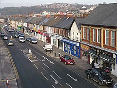
Shaftesbury, Newport
| Shaftesbury | |
|---|---|
 | |
 Shaftesbury Location within Newport | |
| Population | 5,135 (2011 census)[1] |
| OS grid reference | ST309896 |
| Principal area | |
| Country | Wales |
| Sovereign state | United Kingdom |
| Post town | NEWPORT |
| Postcode district | NP20 5 |
| Dialling code | 01633 Chartist exchange |
| Police | Gwent |
| Fire | South Wales |
| Ambulance | Welsh |
| UK Parliament | |
Shaftesbury is an electoral district (ward) and coterminous community (parish) of the city of Newport, South Wales.
The ward is bounded by the River Usk to the east and southeast, the Great Western Main Line to the south, the A4042 road to the southwest as far as the Harlequin intersection, at which point the border diverts up Barrack Hill behind Harlequin Drive, Power Street and Lambert Close to meet the Monmouthshire Canal which then forms the western boundary as far as Bettws Lane Bridge. The northern boundary is formed by the western and northern edges of Graig Wood, Yewberry Lane and south of Grove Park Drive. The area is governed by the Newport City Council.
References[]
- ^ "Newport ward 2011". Retrieved 5 April 2015.
External links[]
| Wikimedia Commons has media related to Shaftesbury, Newport. |

This Newport location article is a stub. You can help Wikipedia by . |
Categories:
- Communities in Newport, Wales
- Wards of Newport, Wales
- Newport, Wales geography stubs