Sheshegwaning First Nation
Sheshegwaning 20 | |
|---|---|
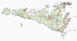
| Sheshegwaning Indian Reserve No. 20 | |
 | |
 Sheshegwaning 20 | |
| Coordinates: 45°56′N 82°51′W / 45.933°N 82.850°WCoordinates: 45°56′N 82°51′W / 45.933°N 82.850°W | |
| Country | Canada |
| Province | Ontario |
| District | Manitoulin |
| First Nation | Sheshegwaning |
| Area | |
| • Land | 20.28 km2 (7.83 sq mi) |
| Population (2011)[1] | |
| • Total | 118 |
| • Density | 5.8/km2 (15/sq mi) |
| Website | www.sheshegwaning.org |


Sheshegwaning First Nation is an Odawa First Nation on Manitoulin Island in Ontario, Canada. Its land base is located on the Sheshegwaning 20 reserve.

Sheshegwaning administration building
References[]
- ^ Jump up to: a b "Sheshegwaning 20 census profile". 2011 Census of Population. Statistics Canada. Retrieved 22 June 2015.
| show Places adjacent to Sheshegwaning First Nation |
|---|
| show Authority control |
|---|
This Northern Ontario geographical article is a stub. You can help Wikipedia by . |
This article about an Indian reserve in Ontario is a stub. You can help Wikipedia by . |
Categories:
- Odawa reserves in Ontario
- Ojibwe governments
- Communities in Manitoulin Island
- Northern Ontario geography stubs
- Ontario Indian reserve stubs