Shiremanstown, Pennsylvania
Shiremanstown, Pennsylvania | |
|---|---|
Borough | |
 St. John's Lutheran Church | |
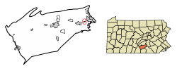 Location of Shiremanstown in Cumberland County, Pennsylvania | |
 Shiremanstown Location in Pennsylvania and the United States | |
| Coordinates: 40°13′22″N 76°57′15″W / 40.22278°N 76.95417°WCoordinates: 40°13′22″N 76°57′15″W / 40.22278°N 76.95417°W | |
| Country | United States |
| State | Pennsylvania |
| County | Cumberland |
| Government | |
| • Type | Borough Council |
| Area | |
| • Total | 0.31 sq mi (0.79 km2) |
| • Land | 0.31 sq mi (0.79 km2) |
| • Water | 0.00 sq mi (0.00 km2) |
| Elevation | 420 ft (130 m) |
| Population (2010) | |
| • Total | 1,569 |
| • Estimate (2019)[2] | 1,628 |
| • Density | 5,320.26/sq mi (2,052.32/km2) |
| Time zone | UTC-5 (Eastern (EST)) |
| • Summer (DST) | UTC-4 (EDT) |
| ZIP code | 17011 |
| Area code(s) | 717 |
| FIPS code | 42-70384 |


Shiremanstown is a borough in Cumberland County, Pennsylvania, United States. The population was 1,569 at the 2010 census.[3]
Shiremanstown is part of the Harrisburg–Carlisle Metropolitan Statistical Area.
Geography[]
Shiremanstown is located in eastern Cumberland County at 40°13′22″N 76°57′15″W / 40.222889°N 76.954159°W.[4] It is bordered to the north by Hampden Township and to the south by Lower Allen Township. It is 6 miles (10 km) southwest of the center of Harrisburg, the state capital. According to the United States Census Bureau, the borough has a total area of 0.30 square miles (0.77 km2), all of it land.[3]
Demographics[]
| Historical population | |||
|---|---|---|---|
| Census | Pop. | %± | |
| 1880 | 404 | — | |
| 1890 | 432 | 6.9% | |
| 1900 | 504 | 16.7% | |
| 1910 | 545 | 8.1% | |
| 1920 | 635 | 16.5% | |
| 1930 | 731 | 15.1% | |
| 1940 | 777 | 6.3% | |
| 1950 | 887 | 14.2% | |
| 1960 | 1,212 | 36.6% | |
| 1970 | 1,773 | 46.3% | |
| 1980 | 1,719 | −3.0% | |
| 1990 | 1,567 | −8.8% | |
| 2000 | 1,521 | −2.9% | |
| 2010 | 1,569 | 3.2% | |
| 2019 (est.) | 1,628 | [2] | 3.8% |
| Sources:[5][6][7] | |||
As of the 2000 census,[6] there were 1,521 people, 719 households, and 407 families residing in the borough. The population density was 5,105.8 people per square mile (1,957.5/km2). There were 742 housing units at an average density of 2,490.8 per square mile (955.0/km2). The racial makeup of the borough was 95.33% White, 0.53% African American, 0.07% Native American, 2.43% Asian, 0.33% from other races, and 1.31% from two or more races. Hispanic or Latino of any race were 0.53% of the population.
There were 719 households, out of which 22.5% had children under the age of 18 living with them, 46.2% were married couples living together, 8.8% had a female householder with no husband present, and 43.3% were non-families. 38.0% of all households were made up of individuals, and 11.7% had someone living alone who was 65 years of age or older. The average household size was 2.12 and the average family size was 2.83.
In the borough the population was spread out, with 20.2% under the age of 18, 7.0% from 18 to 24, 29.9% from 25 to 44, 23.6% from 45 to 64, and 19.3% who were 65 years of age or older. The median age was 40 years. For every 100 females, there were 84.6 males. For every 100 females age 18 and over, there were 84.5 males.
The median household income in the borough was $43,971, and the median income for a family was $55,268. Males had a median income of $37,500 versus $30,326 for females. The per capita income for the borough was $21,812. About 1.8% of families and 5.0% of the population were below the poverty line, including 3.5% of those under age 18 and 2.8% of those age 65 or over.
References[]
- ^ "2019 U.S. Gazetteer Files". United States Census Bureau. Retrieved July 28, 2020.
- ^ Jump up to: a b "Population and Housing Unit Estimates". United States Census Bureau. May 24, 2020. Retrieved May 27, 2020.
- ^ Jump up to: a b "Geographic Identifiers: 2010 Census Summary File 1 (G001): Shiremanstown borough, Pennsylvania". U.S. Census Bureau, American Factfinder. Archived from the original on February 13, 2020. Retrieved June 18, 2015.
- ^ "US Gazetteer files: 2010, 2000, and 1990". United States Census Bureau. 2011-02-12. Retrieved 2011-04-23.
- ^ "Census of Population and Housing". U.S. Census Bureau. Retrieved December 11, 2013.
- ^ Jump up to: a b "U.S. Census website". United States Census Bureau. Retrieved 2008-01-31.
- ^ "Incorporated Places and Minor Civil Divisions Datasets: Subcounty Resident Population Estimates: April 1, 2010 to July 1, 2012". Population Estimates. U.S. Census Bureau. Archived from the original on June 17, 2013. Retrieved December 11, 2013.
External links[]
| show Municipalities and communities of Cumberland County, Pennsylvania, United States |
|---|

| show Authority control |
|---|
- Populated places established in 1813
- Harrisburg–Carlisle metropolitan statistical area
- Boroughs in Cumberland County, Pennsylvania