Shughnon Range
| Shughnon Range Шугнанский хребет | |
|---|---|
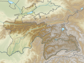
 Location in Tajikistan | |
| Highest point | |
| Peak | Pik Skalisty |
| Elevation | 5,704 m (18,714 ft) |
| Dimensions | |
| Length | 80 km (50 mi) E/W |
| Area | 150 km2 (58 sq mi) |
| Geography | |
| Country | Tajikistan |
| Range coordinates | 37°36′N 72°14′E / 37.600°N 72.233°ECoordinates: 37°36′N 72°14′E / 37.600°N 72.233°E |
| Parent range | Pamir Mountains |
Shughnon Range or Shugnan Range (Russian: Шугнанский хребет) is a mountain range in Tajikistan, part of the Pamir Mountain System. Administratively it is located in Tajikistan's Region of Republican Subordination.[1]
Geography[]
The Shughnon Range stretches between the river valleys of the Gunt in the north and its tributary the in the south. Its slopes are covered in alpine meadows and steppe.[2] There are glaciated areas in the range.[3]
Its highest summit is 5,704 m high Pik Skalisty.[2]
See also[]
- List of mountains in Tajikistan
References[]
Categories:
- Mountain ranges of Tajikistan
- Districts of Republican Subordination
- Pamir Mountains
- Tajikistan geography stubs

