Shumway, Illinois
Shumway, Illinois | |
|---|---|
 Trinity Lutheran Church | |
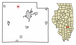 Location of Shumway in Effingham County, Illinois. | |
 Location of Illinois in the United States | |
| Coordinates: 39°11′3″N 88°39′11″W / 39.18417°N 88.65306°WCoordinates: 39°11′3″N 88°39′11″W / 39.18417°N 88.65306°W | |
| Country | United States |
| State | Illinois |
| County | Effingham |
| Area | |
| • Total | 0.33 sq mi (0.86 km2) |
| • Land | 0.33 sq mi (0.86 km2) |
| • Water | 0.00 sq mi (0.00 km2) |
| Population (2010) | |
| • Total | 202 |
| • Estimate (2019)[2] | 195 |
| • Density | 587.35/sq mi (226.68/km2) |
| Time zone | UTC-6 (CST) |
| • Summer (DST) | UTC-5 (CDT) |
| ZIP Code(s) | 62461 |
| Area code(s) | 217 |
| FIPS code | 17-69797 |
| Wikimedia Commons | Shumway, Illinois |

Shumway is a village in Effingham County, Illinois, United States. As of the 2010 census, the village population was 202.[3] Shumway is part of the Effingham, IL Micropolitan Statistical Area.
Geography[]
Shumway is located in northern Effingham County at 39°11′3″N 88°39′11″W / 39.18417°N 88.65306°W (39.184144, -88.652977).[4] Illinois Route 33 crosses the southwest corner of the village, leading southeast 8 miles (13 km) to Effingham, the county seat, and west 7 miles (11 km) to Beecher City.
According to the 2010 census, Shumway has a total area of 0.33 square miles (0.85 km2), all land.[5]
Education[]
Shumway is in the Beecher City/Shumway School District., although in earlier years, rural Shumway residents in Summit Township have filed petitions to leave the district. Older residents of this area still hold allegiances to Effingham High School. The reason for this "allegiance" was because when Shumway High School closed, many students east and south of Shumway went to Effingham schools. When districts were drawn many residents felt Beecher City gerrymandered Shumway into the district. Today, many kids around Lake Sara and east Shumway attend Beecher City, although Effingham Community schools are much closer.
Demographics[]
| Historical population | |||
|---|---|---|---|
| Census | Pop. | %± | |
| 1880 | 130 | — | |
| 1900 | 258 | — | |
| 1910 | 291 | 12.8% | |
| 1920 | 269 | −7.6% | |
| 1930 | 178 | −33.8% | |
| 1940 | 180 | 1.1% | |
| 1950 | 248 | 37.8% | |
| 1960 | 212 | −14.5% | |
| 1970 | 235 | 10.8% | |
| 1980 | 278 | 18.3% | |
| 1990 | 243 | −12.6% | |
| 2000 | 217 | −10.7% | |
| 2010 | 202 | −6.9% | |
| 2019 (est.) | 195 | [2] | −3.5% |
| U.S. Decennial Census[6] | |||
As of the census[7] of 2000, there were 217 people, 82 households, and 56 families residing in the village. The population density was 696.1 people per square mile (270.3/km2). There were 97 housing units at an average density of 311.2 per square mile (120.8/km2). The racial makeup of the village was 100.00% White.
There were 82 households, out of which 40.2% had children under the age of 18 living with them, 47.6% were married couples living together, 17.1% had a female householder with no husband present, and 30.5% were non-families. 25.6% of all households were made up of individuals, and 11.0% had someone living alone who was 65 years of age or older. The average household size was 2.65 and the average family size was 3.18.
In the village, the population was spread out, with 28.1% under the age of 18, 12.9% from 18 to 24, 28.6% from 25 to 44, 19.4% from 45 to 64, and 11.1% who were 65 years of age or older. The median age was 31 years. For every 100 females, there were 102.8 males. For every 100 females age 18 and over, there were 100.0 males.
The median income for a household in the village was $43,125, and the median income for a family was $45,417. Males had a median income of $27,159 versus $18,750 for females. The per capita income for the village was $16,032. About 5.8% of families and 8.0% of the population were below the poverty line, including 8.0% of those under the age of eighteen and 15.4% of those 65 or over.
References[]
- ^ "2019 U.S. Gazetteer Files". United States Census Bureau. Retrieved July 14, 2020.
- ^ a b "Population and Housing Unit Estimates". United States Census Bureau. May 24, 2020. Retrieved May 27, 2020.
- ^ "Geographic Identifiers: 2010 Demographic Profile Data (G001): Shumway village, Illinois". American Factfinder. U.S. Census Bureau. Archived from the original on February 13, 2020. Retrieved January 29, 2016.
- ^ "US Gazetteer files: 2010, 2000, and 1990". United States Census Bureau. February 12, 2011. Retrieved April 23, 2011.
- ^ "G001 - Geographic Identifiers - 2010 Census Summary File 1". United States Census Bureau. Archived from the original on February 13, 2020. Retrieved December 25, 2015.
- ^ "Census of Population and Housing". Census.gov. Retrieved June 4, 2015.
- ^ "U.S. Census website". United States Census Bureau. Retrieved January 31, 2008.
Municipalities and communities of Effingham County, Illinois, United States | ||
|---|---|---|
| Cities | ||
| Town | ||
| Villages | ||
| Townships | ||
| Unincorporated communities | ||
| Footnotes | ‡This populated place also has portions in an adjacent county or counties | |
| ||
- Villages in Effingham County, Illinois
- Villages in Illinois