Smithville, Mississippi
Smithville, Mississippi | |
|---|---|
| City of Smithville | |
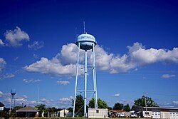 Water tower in Smithville | |
 Location of Smithville, Mississippi | |
 Smithville, Mississippi Location in the United States | |
| Coordinates: 34°4′7″N 88°23′44″W / 34.06861°N 88.39556°WCoordinates: 34°4′7″N 88°23′44″W / 34.06861°N 88.39556°W | |
| Country | United States |
| State | Mississippi |
| County | Monroe |
| Area | |
| • Total | 1.61 sq mi (4.17 km2) |
| • Land | 1.48 sq mi (3.84 km2) |
| • Water | 0.12 sq mi (0.32 km2) |
| Elevation | 262 ft (80 m) |
| Population | |
| • Total | 942 |
| • Estimate (2019)[3] | 737 |
| • Density | 496.63/sq mi (191.78/km2) |
| Time zone | UTC-6 (Central (CST)) |
| • Summer (DST) | UTC-5 (CDT) |
| ZIP code | 38870 |
| Area code(s) | 662 |
| FIPS code | 28-68720 |
| GNIS feature ID | 0677945 |
| Website | www |

Smithville is a town in Monroe County, Mississippi. The population was 942 at the 2010 census. Smithville is the birthplace of Rod Brasfield, a member of the Country Music Hall of Fame.
History[]
Smithville is located on lands purchased from Chickasaw chief Che-lah-cha-chubby in 1836. The town is named for William Smith, an early settler who established a store at the site around 1840. The town was incorporated in 1845.[4]
2011 tornado[]
On April 27, 2011, at approximately 3:45 p.m. CDT, an EF5 tornado struck the town with winds which were estimated to have peaked at 205 mph (330 km/h).[5] A total of 16 people were killed,[6] and 40 people were injured.[5] In total, 117 structures were destroyed and 50 more sustained major damage from the storm in Monroe County alone, before the tornado continued into Itawamba County. In Smithville, an SUV was lofted and thrown a half mile into the water tower, before being carried even further downwind. Other damage included the complete destruction of the city hall, post office, police station, and four churches, along with appliances and plumbing fixtures being shredded or ripped away from foundations and numerous granite tombstones being knocked down.[7]
Geography[]
Smithville is located at 34°4′7″N 88°23′44″W / 34.06861°N 88.39556°W (34.068605, -88.395486).[8] The town is situated along the east bank of Tennessee-Tombigbee Waterway in northern Monroe County. The waterway's Glover Wilkins Lock is located just downstream. Mississippi Highway 25 traverses Smithville, connecting the town with Fulton to the north and Amory to the south.
According to the United States Census Bureau, the town has a total area of 1.6 square miles (4.1 km2), of which 1.5 square miles (3.9 km2) is land and 0.1 square miles (0.26 km2) (8.12%) is water.
Demographics[]
| Historical population | |||
|---|---|---|---|
| Census | Pop. | %± | |
| 1900 | 150 | — | |
| 1910 | 179 | 19.3% | |
| 1920 | 138 | −22.9% | |
| 1930 | 401 | 190.6% | |
| 1940 | 402 | 0.2% | |
| 1950 | 419 | 4.2% | |
| 1960 | 489 | 16.7% | |
| 1970 | 552 | 12.9% | |
| 1980 | 866 | 56.9% | |
| 1990 | 871 | 0.6% | |
| 2000 | 882 | 1.3% | |
| 2010 | 942 | 6.8% | |
| 2019 (est.) | 737 | [3] | −21.8% |
| U.S. Decennial Census[9] | |||
As of the census[10] of 2000, there were 882 people, 365 households, and 243 families residing in the town. The population density 602.1 people per square mile (233.2/km2). There were 404 housing units at an average density of 275.8 per square mile (106.8/km2). The racial makeup of the town is 97.62% White, 1.59% African American, 0.11% Native American, 0.23% Asian, 0.23% from other races, and 0.23% from two or more races. Hispanic or Latino of any race were 0.79% of the population.
There were 365 households, out of which 33.7% had children under the age of 18 living with them, 47.9% were married couples living together, 14.5% had a female householder with no husband present, and 33.4% were non-families. 32.1% of all households were made up of individuals, and 18.4% had someone living alone who 65 years of age or older. The average household size 2.42 and the average family size 3.03.
In the town, the population spread out, with 26.2% under the age of 18, 10.2% from 18 to 24, 25.2% from 25 to 44, 22.9% from 45 to 64, and 15.5% who were 65 years of age or older. The median age 36 years. For every 100 females, there were 95.1 males. For every 100 females age 18 and over, there were 83.9 males.
The median income for a household in the town $32,583, and the median income for a family $38,750. Males had a median income of $30,294 versus $23,958 for females. The per capita income for the town $14,030. About 7.1% of families and 11.2% of the population were below the poverty line, including 9.7% of those under age 18 and 18.7% of those age 65 or over.
Education[]
The Town of Smithville is served by the Monroe County School District.[11]
Sports[]
Smithville High School won two 1A football state championships in 1993 and 1998. The school previously vied for the title in 1989, losing to a Mt. Olive (MS) team quarterbacked by future NFL great Steve McNair. The Smithville High School softball team has won the 1A state championship in 2008, 2011, and 2012.[12] The Smithville High School Band has won two state Marching Championships.
References[]
- ^ "2019 U.S. Gazetteer Files". United States Census Bureau. Retrieved July 26, 2020.
- ^ "2010 City Population and Housing Occupancy Status". U.S. Census Bureau. Retrieved May 14, 2012.[dead link]
- ^ a b "Population and Housing Unit Estimates". United States Census Bureau. May 24, 2020. Retrieved May 27, 2020.
- ^ Dalrymple Family Foundation historical marker at Smithville Town Hall. Information accessed 15 September 2018.
- ^ a b Public Information Statement. 29 April 2011, NOAA-National Weather Service Weather Forecast Office, Memphis, TN. Retrieved 1 May 2011
- ^ "Smithville Tornado Victim Dies," Monroe360.com, April 2011. Accessed at the Internet Archive, 18 September 2018.
- ^ National Climatic Data Center (2011). "NCDC Storm Events Database". National Oceanic and Atmospheric Administration. Retrieved April 26, 2011.
- ^ "US Gazetteer files: 2010, 2000, and 1990". United States Census Bureau. 2011-02-12. Retrieved 2011-04-23.
- ^ "Census of Population and Housing". Census.gov. Retrieved June 4, 2015.
- ^ "U.S. Census website". United States Census Bureau. Retrieved 2008-01-31.
- ^ "SCHOOL DISTRICT REFERENCE MAP (2010 CENSUS): Monroe County, MS" (PDF). U.S. Census Bureau. Retrieved 2021-03-05.
- ^ "High School Baseball/Softball Scores". Northeast Mississippi Daily Journal. Retrieved May 22, 2012.
External links[]
 Media related to Smithville, Mississippi at Wikimedia Commons
Municipalities and communities of Monroe County, Mississippi, United States | ||
|---|---|---|
| Cities |  | |
| Towns | ||
| Village | ||
| CDPs |
| |
| Other communities | ||
| Ghost towns | ||
| Footnotes | ‡This town also has portions in adjacent county or counties | |
| ||
- Towns in Monroe County, Mississippi
- Towns in Mississippi