Snake Bay Airport
Snake Bay Airport | |||||||||||
|---|---|---|---|---|---|---|---|---|---|---|---|
| Summary | |||||||||||
| Airport type | Public | ||||||||||
| Operator | Tiwi Island Regional Council | ||||||||||
| Serves | Melville Island, Australia | ||||||||||
| Location | Milikapiti, Northern Territory | ||||||||||
| Elevation AMSL | 173 ft / 53 m | ||||||||||
| Coordinates | 11°25′22″S 130°39′13″E / 11.42278°S 130.65361°ECoordinates: 11°25′22″S 130°39′13″E / 11.42278°S 130.65361°E | ||||||||||
| Map | |||||||||||
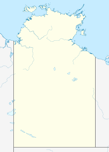 YSNB Location in the Northern Territory | |||||||||||
| Runways | |||||||||||
| |||||||||||

Snake Bay Airport (IATA: SNB, ICAO: YSNK) is located at Milikapiti, Northern Territory on the northern coast of Melville Island, Australia.
History[]
World War II[]
The Royal Australian Air Force (RAAF) built the airfield as a forward fighter aerodrome, during World War II as part of the proposed strategic amphibious operations by Allied forces against the Tanimbar Islands and Kai Islands. It was proposed to accommodate a RAAF Fighter Wing and a United States Army Air Forces Fighter Group.
Construction was started on 7 July 1944, by with the help of 40 Aborigines. The airfield was operational on 30 August 1944. Two side by side runways 1,829 m (6,001 ft) long were constructed.[2]
The airfield was never fully utilized as the proposed amphibious operations were canceled and replaced with the New Guinea campaign. The airfield was known as Austin Strip and RAAF Melville Island.
Units based at Austin Strip[]
Airlines and destinations[]
| Airlines | Destinations |
|---|---|
| Darwin | |
| Fly Tiwi | Darwin, Pularumpi |
See also[]
References[]
- ^ YSNK – Snake Bay (PDF). AIP En Route Supplement from Airservices Australia, effective 2 Dec 2021, Aeronautical Chart Archived 13 January 2022 at the Wayback Machine
- ^ OzatWar website
External links[]
- Airports in the Northern Territory
- Former Royal Australian Air Force bases
- 1944 establishments in Australia
- Airports established in 1944
- Airfields of the United States Army Air Forces in Australia
- World War II airfields in Australia