Groote Eylandt Airport
This article needs additional citations for verification. (May 2021) |
Groote Eylandt Airport | |||||||||||
|---|---|---|---|---|---|---|---|---|---|---|---|
| Summary | |||||||||||
| Airport type | Public | ||||||||||
| Operator | Groote Eylandt Mining Co. | ||||||||||
| Serves | Groote Eylandt, Northern Territory, Australia | ||||||||||
| Location | Angurugu | ||||||||||
| Elevation AMSL | 53 ft / 16 m | ||||||||||
| Coordinates | 13°58′30″S 136°27′36″E / 13.97500°S 136.46000°ECoordinates: 13°58′30″S 136°27′36″E / 13.97500°S 136.46000°E | ||||||||||
| Map | |||||||||||
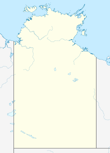
 YGTE Location in the Northern Territory | |||||||||||
| Runways | |||||||||||
| |||||||||||
Groote Eylandt Airport (IATA: GTE, ICAO: YGTE) is an airport serving Groote Eylandt,[1] an island in the Gulf of Carpentaria in Northern Territory, Australia. The airport is operated by the Groote Eylandt Mining Co.[1] and is located north of the community of Angurugu.
Facilities[]
The airport resides at an elevation of 53 ft (16 m) above sea level. It has one runway designated 10/28 with an asphalt surface measuring 1,901 m × 30 m (6,237 ft × 98 ft).[1]
Airlines and destinations[]
| Airlines | Destinations |
|---|---|
| Airnorth | Darwin, Gove |
| Alliance Airlines | Cairns |
See also[]
References[]
- ^ a b c d YGTE – Groote Eylandt (PDF). AIP En Route Supplement from Airservices Australia, effective 2 Dec 2021, Aeronautical Chart
External links[]
Categories:
- Airports in the Northern Territory
- Groote Eylandt
- Australian airport stubs
- Northern Territory stubs
