Soľník
This article does not cite any sources. (January 2008) |
Soľník | |
|---|---|
Municipality | |
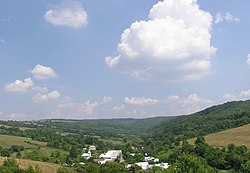 | |
 Soľník Location of Soľník in the Prešov Region | |
| Coordinates: 49°13′00″N 21°44′30″E / 49.21667°N 21.74167°ECoordinates: 49°13′00″N 21°44′30″E / 49.21667°N 21.74167°E | |
| Country | |
| Region | Prešov |
| District | Stropkov |
| First mentioned | 1454 |
| Area | |
| • Total | 4.401 km2 (1.699 sq mi) |
| Elevation | 284 m (932 ft) |
| Population | |
| • Total | 44 |
| • Density | 10.0/km2 (26/sq mi) |
| Time zone | UTC+1 (CET) |
| • Summer (DST) | UTC+2 (CEST) |
| Postal code | 090 31 (pošta Kolbovce) |
| Area code(s) | +421-54 |
| Car plate | SP |


Soľník is a village and municipality in Stropkov District in the Prešov Region of north-eastern Slovakia.
History[]
In historical records the village was first mentioned in 1454.
Geography[]
The municipality lies at an altitude of 284 metres and covers an area of 4.401 km². It has a population of about 44 people.
External links[]
 Media related to Soľník at Wikimedia Commons
- http://www.statistics.sk/mosmis/eng/run.html
This Prešov Region geography article is a stub. You can help Wikipedia by . |
Categories:
- Villages and municipalities in Stropkov District
- Rusyn villages
- Prešov Region geography stubs