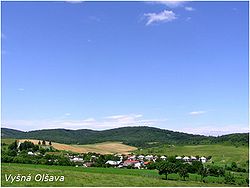
Vyšná Olšava
Vyšná Olšava | |
|---|---|
Municipality | |
 | |
 Vyšná Olšava Location of Vyšná Olšava in the Prešov Region | |
| Coordinates: 49°10′N 21°36′E / 49.167°N 21.600°ECoordinates: 49°10′N 21°36′E / 49.167°N 21.600°E | |
| Country | |
| Region | Prešov |
| District | Stropkov |
| First mentioned | 1382 |
| Area | |
| • Total | 13.77 km2 (5.32 sq mi) |
| Elevation | 219 m (719 ft) |
| Population (2004-12-31) | |
| • Total | 599 |
| • Density | 44/km2 (110/sq mi) |
| Time zone | UTC+1 (CET) |
| • Summer (DST) | UTC+2 (CEST) |
| Postal code | 090 32 (pošta Miňovce) |
| Area code(s) | +421-54 |
| Car plate | SP |
| Website | www |


Vyšná Olšava is a village and municipality in Stropkov District in the Prešov Region of north-eastern Slovakia.
History[]
In historical records the village was first mentioned in 1382.
Geography[]
The municipality lies at an altitude of 219 metres and covers an area of 13.772 km². It has a population of about 600 people.
External links[]
 Media related to Vyšná Olšava at Wikimedia Commons
- Official website

This Prešov Region geography article is a stub. You can help Wikipedia by . |
Categories:
- Villages and municipalities in Stropkov District
- Zemplín (region)
- Prešov Region geography stubs