South West Isle (Tasmania)
 The South West Isle, as located within the Kent Group. | |
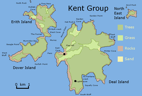
 South West Isle Location of the South West Isle in Bass Strait | |
| Geography | |
|---|---|
| Location | Bass Strait |
| Coordinates | 39°31′12″S 147°07′12″E / 39.52000°S 147.12000°ECoordinates: 39°31′12″S 147°07′12″E / 39.52000°S 147.12000°E |
| Archipelago | Kent Group |
| Area | 19.1 ha (47 acres) |
| Highest elevation | 120 m (390 ft) |
| Administration | |
Australia | |
| State | Tasmania |
| Demographics | |
| Population | unpopulated |

The South West Isle, part of the Kent Group, is an unpopulated 19.09-hectare (47.2-acre) granite island, located in the Bass Strait, lying off the north-east coast of Tasmania, between the Furneaux Group and Wilsons Promontory in Victoria, Australia.[1]
The island has a peak elevation of 120 metres (390 ft) and is contained within the Kent Group National Park, Tasmania's northernmost national park, which was gazetted in 2002.
Fauna[]
Recorded breeding seabird, wader and waterbird species include little penguin, short-tailed shearwater, fairy prion, common diving-petrel, Pacific gull, silver gull, sooty oystercatcher and Cape Barren goose. Reptiles present are the metallic skink, Bougainville's skink and White's skink.[2]
See also[]
References[]
- ^ "South West Isle (TAS)". Gazetteer of Australia online. Geoscience Australia, Australian Government.
- ^ Brothers, Nigel; Pemberton, David; Pryor, Helen; & Halley, Vanessa. (2001). Tasmania’s Offshore Islands: seabirds and other natural features. Tasmanian Museum and Art Gallery: Hobart. ISBN 0-7246-4816-X
External links[]
- Parks and Wildlife Service (2005). Kent Group National Park (Terrestrial Portion) Management Plan 2005. Department of Tourism, Parks, Heritage and the Arts. Hobart: Tasmanian Government. ISBN 0-9751743-4-7.
This Tasmania geography article is a stub. You can help Wikipedia by . |
- Protected areas of Tasmania
- Islands of Bass Strait
- Tasmania geography stubs